ExpertGPS 8.63

New Version

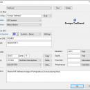
... your waypoints, routes, and tracks on USGS topo maps and aerial photos. Using the powerful mapping tools in ExpertGPS, you can draw your route directly on a map, search for nearby features from the millions of waypoints available in our database, and transfer your trip directly to your GPS in one click. ...

Author TopoGrafix
License Trialware
Price $74.95
Released 2024-04-15
Downloads 1617
Filesize 13.50 MB
Requirements
Installation Instal And Uninstall
Keywords GPS map, display waypoint, retrieve map, GPS, map, display
Users' rating
(20 rating)
ExpertGPSCADWindows XP, Windows Vista, Windows Vista x64, Windows 7, Windows 7 x64, Windows 8, Windows 8 x64, Windows 10, Windows 10 x64, Windows 11
ExpertGPS maps - Download Notice

Using ExpertGPS Free Download crack, warez, password, serial numbers, torrent, keygen, registration codes, key generators is illegal and your business could subject you to lawsuits and leave your operating systems without patches. We do not host any torrent files or links of ExpertGPS on rapidshare.com, depositfiles.com, megaupload.com etc. All ExpertGPS download links are direct ExpertGPS full download from publisher site or their selected mirrors.
Avoid: maps oem software, old version, warez, serial, torrent, ExpertGPS keygen, crack.
Consider: ExpertGPS full version, maps full download, premium download, licensed copy.

ExpertGPS maps - The Latest User Reviews

Most popular CAD downloads

ExpertGPS

8.63 download

... your waypoints, routes, and tracks on USGS topo maps and aerial photos. Using the powerful mapping ... a software that allows you display routes and maps. ExpertGPS uses your Internet connection to retrieve maps ...

New Version

PyMOL

3.0.2 download

... files to multi-SDF files to volumetric electron density maps. PyMOL's straightforward graphical user interface allows first-time and expert users alike to create stunning 3-D images from their favorite file formats. ...

TNTmips

20240404 download

... formats without importing. Overlay your geodata on Bing Maps imagery and maps or on geodata layers published on the Internet ...

ShelXle

1.0 Rev 1634 download

... the electron density (Fo) and difference density (Fo-Fc) maps. See J. Appl. Cryst. (2011). 44, 1281–1284. for details. ...

New Version

R2V

3.66 download

... R2V converts architect, mechanical and various technical drawings, maps and other types from raster to vector format. A vector format can be imported into your CAD/CAM or drawing program. R2V ...

Elshayal Smart

23.02 download

... independent of any commercial software package. Download Maps from Google Earth, and Trace & save GPS route and View and Rectify Raster Images gif, jpg, bmp and Edit shape ...

Panoply for Mac

5.3.4 download

... can project the analysis using more than 100 maps. What’s more, you get to overlay continent, or other types of masks on top of the generated arrays. You ...

Screen Protractor

4.0 download

The Screen Protractor allows you to easily and quickly measure any angle on the screen to the nearest Degree or Radian. This perfect compliment to the Screen Calipers, the Protractor is ...

Screen Protractor Mac Edition

3.2 download

The Screen Protractor allows you to easily and quickly measure any angle on the screen to the nearest Degree or Radian. This perfect compliment to the Screen Calipers, the Protractor is ...

RTOPO Hydrology

3.4 download

... surveying. You can do triangulation, isolines, color-filled contour maps, sections, intersections, volume and much more. You can ... -the conversion of the existing isolines resulting from maps in points and then in a triangulation -represent ...