TNTmips for Mac OS X 20240111

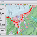
... and modify GIS images. It is a professional application that can handle desktop cartography, electronic atlas preparation and spatial database management. ...

Author MicroImages, Inc.
License Freeware
Price FREE
Released 2024-01-11
Downloads 224
Filesize 87.90 MB
Requirements Mac (OS 10.8 to 11), XQuartz 2.7.9 needed (2.7.11 with manual modification)
Installation Instal And Uninstall
Keywords GIS data analysis, analyze geodetic data, edit GIS dataset, GIS, dataset, editor, analysis, mac os, TNTmips for mac, TNTgis for mac, TNTedit
Users' rating
(28 rating)
TNTmips for Mac OS XCADMac OS X
TNTmips for Mac OS X database application - Download Notice

Using TNTmips for Mac OS X Free Download crack, warez, password, serial numbers, torrent, keygen, registration codes, key generators is illegal and your business could subject you to lawsuits and leave your operating systems without patches. We do not host any torrent files or links of TNTmips for Mac OS X on rapidshare.com, depositfiles.com, megaupload.com etc. All TNTmips for Mac OS X download links are direct TNTmips for Mac OS X full download from publisher site or their selected mirrors.
Avoid: database application oem software, old version, warez, serial, torrent, TNTmips for Mac OS X keygen, crack.
Consider: TNTmips for Mac OS X full version, database application full download, premium download, licensed copy.

TNTmips for Mac OS X database application - The Latest User Reviews

Most popular CAD downloads

TNTmips

20240404 download

... imagery, terrain surfaces, and map data with associated database attributes. It provides all the tools you need ... export an unsurpassed number of raster, geometric, and database file formats; convert between data types; and link ...

QGIS

3.36.1 download

QGIS is a professional GIS application that is built on top of and proud ... Software (FOSS). QGIS supports vector, raster, and database formats and lets you browse and create map ...

QGIS for Mac

3.36.1 download

QGIS is a professional GIS application that is built on top of and proud ... Software (FOSS). QGIS supports vector, raster, and database formats and lets you browse and create map ...

QGIS for Linux

3.36.1 download

QGIS is a professional GIS application that is built on top of and proud ... Software (FOSS). QGIS supports vector, raster, and database formats and lets you browse and create map ...

Simstat

2.6 download

... to automate statistical analysis and to write small applications, interactive tutorials with multimedia capabilities, as well as ... and annotations. It can import data from various database and spreadsheet formats as well as ASCII and ...

TopoLT

15.2 download

... over 25 years, TopoLT is the oldest topography application in Romania, created to help surveyors to carry ... file which can be imported in ARIA program database; ยท areas can be detached using usual methods ...

Maxsurf

17.07 download

... is opened in other modules. Designs in the database file are extremely compact making them ideal for transmission to designers or builders via email. The interactive graphical environment in Maxsurf ...

MITCalc V-Belts Calculation

1.22 download

... and strength check of belt transmissions using V-belts. Application is developed in MS Excel, is multi-language, supports ... ZWCAD, ProgeCAD, Autodesk Inventor, SolidWorks, SolidEdge, Creo). The application works with CAD systems and includes respective models ...

MITCalc Timing Belts Calculation

1.21 download

... design and strength check of toothed belt transmissions. Application is developed in MS Excel, is multi-language, supports ... ZWCAD, ProgeCAD, Autodesk Inventor, SolidWorks, SolidEdge, Creo). The application works with CAD systems and includes the respective ...

MITCalc Rolling Bearings Calculation I

1.20 download

... of a suitable bearing. The document includes a database of approx. 10,000 different rolling bearings SKF in all basic types and design. - Calculation of basic bearing parameters (life, static ...