TNTmips 20240404

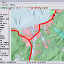
... It is a professional application that can handle desktop cartography, electronic atlas preparation and spatial database management. ...

Author MicroImages, Inc.
License Freeware
Price FREE
Released 2024-04-04
Downloads 714
Filesize 121.00 MB
Requirements
Installation Instal And Uninstall
Keywords GIS data analysis, analyze geodetic data, edit GIS dataset, GIS, dataset, editor, analysis
Users' rating
(34 rating)
TNTmipsCADWindows XP, Windows Vista, Windows Vista x64, Windows 7, Windows 7 x64, Windows 8, Windows 8 x64, Windows 10, Windows 10 x64, Windows 11
TNTmips desktop software - Download Notice

Using TNTmips Free Download crack, warez, password, serial numbers, torrent, keygen, registration codes, key generators is illegal and your business could subject you to lawsuits and leave your operating systems without patches. We do not host any torrent files or links of TNTmips on rapidshare.com, depositfiles.com, megaupload.com etc. All TNTmips download links are direct TNTmips full download from publisher site or their selected mirrors.
Avoid: desktop software oem software, old version, warez, serial, torrent, TNTmips keygen, crack.
Consider: TNTmips full version, desktop software full download, premium download, licensed copy.

TNTmips desktop software - The Latest User Reviews

Most popular CAD downloads

TNTmips

20240404 download

TNTmips software is a complete Geographic Information System (GIS) that lets you work with virtually any type of geospatial data including imagery, terrain surfaces, and map data with associated database ...

AutoCAD Plant 3D

2025 download

3D plant design software With more cost-effective AutoCADĀ® Plant 3D plant design software, AutoCAD-trained piping designers can create 3D plant designs ... quickly, without the need for CAD administrators. Desktop Subscription gives you access to the latest updates ...

Maze Creator PRO

1.70 download

... powerful version of the Maze Creator family of software products. It contains features that do not exist in the other versions. This version is intended for commercial use by professional ...

5 award

Autodesk Infrastructure Design Suite

2016 download

... lifecycle of your civil engineering projects. Desktop Subscription gives you access to the latest updates and releases, 1-on-1 web support, priority support in the forums, flexible licensing, and ...

ZWCAD+

2023 SP1 download

... is a cost-effective, DWG file format compatible CAD software for the AEC and MCAD industries. It ensures ... devices, which lets you work freely on your desktop and on the go. Main features: ...

Total CAD Converter

1.8 download

... need to convert a single file from your desktop. Click the file and select Convert To option in Windows popup menu. That is very time saving. Command line allows you ...

VID

1.163 download

VID stands for "Virtual Instrument Desktop" alternatively "VID", the Sanskrit root of Vidya, meaning "to know". The VID software allows low cost industry standard Modbus or NetCommander ... in distributed control and monitoring SCADA systems. The Software combines a customisable virtual instrument display with a ...

Thuban for Windows

1.2.2 download

... The FreeGIS Project provides an overview of Free Software GIS projects. Many valuable and highly sophisticated tools ... Thuban makes use of several Free GIS Software components and is itself the basis of advanced ...

Thuban for Mac OS X

1.0.1-3 download

... The FreeGIS Project provides an overview of Free Software GIS projects. Many valuable and highly sophisticated tools ... Thuban makes use of several Free GIS Software components and is itself the basis of advanced ...

Thuban for Linux

1.2.2 download

... The FreeGIS Project provides an overview of Free Software GIS projects. Many valuable and highly sophisticated tools ... Thuban makes use of several Free GIS Software components and is itself the basis of advanced ...