- Software
- - Graphic Apps
- - CAD
- - ExpertGPS
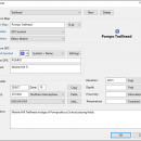
ExpertGPS 8.63
... and tracks on USGS topo maps and aerial photos. Using the powerful mapping tools in ExpertGPS, you can draw your route directly on a map, search for nearby features from the millions of waypoints available in our database, and transfer your trip directly to your GPS in one click. ...
| Author | TopoGrafix |
| License | Trialware |
| Price | $74.95 |
| Released | 2024-04-15 |
| Downloads | 1620 |
| Filesize | 13.50 MB |
| Requirements | |
| Installation | Instal And Uninstall |
| Keywords | GPS map, display waypoint, retrieve map, GPS, map, display |
| Users' rating (20 rating) |
Using ExpertGPS Free Download crack, warez, password, serial numbers, torrent, keygen, registration codes,
key generators is illegal and your business could subject you to lawsuits and leave your operating systems without patches.
We do not host any torrent files or links of ExpertGPS on rapidshare.com, depositfiles.com, megaupload.com etc.
All ExpertGPS download links are direct ExpertGPS full download from publisher site or their selected mirrors.
Avoid: photos oem software, old version, warez, serial, torrent, ExpertGPS keygen, crack.
Consider: ExpertGPS full version, photos full download, premium download, licensed copy.


