Metes and Bounds 6.0.6
Metes and Bounds is a software that can create plot maps, perform calculations in square feets, acres, hectares, perimeter distance and more. Metes and Bounds turns data into a deed plot map. It can calculate square feet, acreage and hectares.
Enter measurements in rods, chains, meters, yards, inches, fathoms, hands, spans or furlongs. Angles can be given down to minutes and seconds. Can auto-close a plot drawing if the final plot segment is missing. Calculate area. Custom labels and backgrounds. Split single plots into multiple plots. GPS Waypoints and more.
The Drawing Wizard is an optional way to start a new drawing. It will ask you several questions about what type of drawing you plan on creating. Based on your answers to these questions, the wizard will preset some of the drawing values to help you accomplish your goals.
FEATURES:
· Perform calculations: Square Feet, Acres, Hectares, perimeter distance and more.
· Easy to use data entry form: Enter lines or curve data.
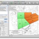
· Layers: Layers allow you to have multiple deeds on a single drawing. Layers can be free floating or locked to a common starting point.
· Metes & Bounds will calculate if the survey closes or not. Calculate closure errors.
· Auto-Completion of drawing. If you're missing the final segment of your land plotting data, let our Metes and Bounds land plotting software finish it for you. Have a bad or missing call? Enter a question mark (?) for the call and let the software find the missing call for you.
· Multiple measurement types: Data can be inputted using Feet, meters, rods, chains, varas and many other measurement types
· Easy to use measuring tool. Estimate the distance between any two points on the screen.
· Automatic labeling: Each line can be automatically labeled with the length and call. End points can be marked for easier recognition. End points can also be labeled with information like the interior and exterior angles.
Create custom labels and backgrounds. Labels can be rotated in 90 degree increments. Drawings can include a call list:
· Backgrounds can be set to scale with your plot drawing.
· Split a single plot into multiple plots. Split the plot by hand, or choose a starting point and let the Metes and Bounds software find the nearest halves automatically for you.
· Create section drawings.
· Exporting: Metes and Bounds data can be exported as a DXF file, KML File, CSV file and more.
· Printing: Printouts can include borders, call list, north arrow and title block.
· Real-world X,Y coordinates. Export real-world X,Y coordinates for integration with other mapping software such as GIS software.
· Custom X,Y points. Use custom X,Y points to mark and label unique land features on the metes and bounds drawing.
· Real-world Latitude and Longitude coordinates. Enter the latitude and longitude for a plot's POB and let the metes and bounds software calculate the latitude and longitude for each of the other end points.
· Waypoints to metes and bounds calls. Convert a set of waypoints, x/y or Latitude/Longitude based, into a list of metes and bounds calls.
· Enter Waypoints and Tracks. Add GPS waypoints and tracks to your drawings. Import GPX and KML files. Make calculations like the distance between two waypoints.
| Author | Sandyknoll Software |
| License | Trialware |
| Price | $39.95 |
| Released | 2024-02-07 |
| Downloads | 965 |
| Filesize | 34.60 MB |
| Requirements | |
| Installation | Instal And Uninstall |
| Keywords | plot map, calculate square feet, calculate acreage, calculator, acreage, perimeter |
| Users' rating (29 rating) |
Using Metes and Bounds Free Download crack, warez, password, serial numbers, torrent, keygen, registration codes,
key generators is illegal and your business could subject you to lawsuits and leave your operating systems without patches.
We do not host any torrent files or links of Metes and Bounds on rapidshare.com, depositfiles.com, megaupload.com etc.
All Metes and Bounds download links are direct Metes and Bounds full download from publisher site or their selected mirrors.
Avoid: oem software, old version, warez, serial, torrent, Metes and Bounds keygen, crack.
Consider: Metes and Bounds full version, full download, premium download, licensed copy.


