- Software
- - Graphic Apps
- - CAD
- - TNTmips
TNTmips 20240404
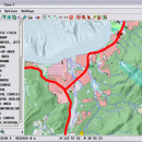
TNTmips software is a complete Geographic Information System (GIS) that lets you work with virtually any type of geospatial data including imagery, terrain surfaces, and map data with associated database attributes. It provides all the tools you need to view, create, edit, georeference, interpret, and publish any type of geospatial data. TNTmips provides professional geospatial tools in a single package at an affordable price without costly add-ons.
Precisely overlay geodata layers in a variety of data types and a multitude of Coordinate Reference Systems. Include layers in a wide variety of external formats without importing. Overlay your geodata on Bing Maps imagery and maps or on geodata layers published on the Internet as web tilesets, Web Map Service (WMS), and ArcIMS ...
Automatically generate hundreds to thousands of control points using a reference image of the same area; manually add tie points in side-by-side and overlay display modes using a reference image; place control points with coordinates from GPS devices ...
Import and export an unsurpassed number of raster, geometric, and database file formats; convert between data types; and link to relational databases. Direct display of popular formats including GeoTIFF, JPEG2000, PNG, MrSID, ECW, shapefile, File Geodatabase, Oracle Spatial, DGN, TAB, DXF, DWG ...
Full-featured GIS that integrates imagery along with geometric data including vector, CAD, shape, pinmap, and TIN formats. Maintain relational database attributes for vector, CAD, and shape layers ...
The Job Processing system lets you schedule processes to run at your convenience. TNT's powerful geospatial scripting language, SML, provides a wide range of options for custom display and processing of your geospatial data.
Construct and transform representations of natural terrains and mathematical surfaces from 3D information. Fast and efficient Surface Fitting, Contouring, and Triangulation operations produce Digital Elevation Model rasters (DEMs), contour lines, and triangulated irregular networks (TINs), respectively ...
| Author | MicroImages, Inc. |
| License | Freeware |
| Price | FREE |
| Released | 2024-04-04 |
| Downloads | 800 |
| Filesize | 121.00 MB |
| Requirements | |
| Installation | Instal And Uninstall |
| Keywords | GIS data analysis, analyze geodetic data, edit GIS dataset, GIS, dataset, editor, analysis |
| Users' rating (64 rating) |
Using TNTmips Free Download crack, warez, password, serial numbers, torrent, keygen, registration codes,
key generators is illegal and your business could subject you to lawsuits and leave your operating systems without patches.
We do not host any torrent files or links of TNTmips on rapidshare.com, depositfiles.com, megaupload.com etc.
All TNTmips download links are direct TNTmips full download from publisher site or their selected mirrors.
Avoid: oem software, old version, warez, serial, torrent, TNTmips keygen, crack.
Consider: TNTmips full version, full download, premium download, licensed copy.


