ShapeBook with 2D3DSteel 4.4.2009

... you can draw 2D steel details and 3D models. Based on AISC Steel Construction Manual 13th Edition. ...

Author South Fork Technologies, Inc.
License Free To Try
Price $149.95
Released 2010-01-21
Downloads 109
Filesize 20.75 MB
Requirements Pentium III or higher, 128MB Ram, 80MB Hard drive space.
Installation Install and Uninstall
Keywords structural, steel, detailing, estimating, dimensions, design, properties, software, reference, tools, construction, reference, information, engineering, fabrication, fabricator, drafting, architecture, beam, column, CAD, drawings, detailing, architect, computer, programs
Users' rating
(28 rating)
ShapeBook with 2D3DSteelCADWin2000, Windows XP, Windows 7 x32, Windows 7 x64, Windows 8, Windows 10, WinServer, WinOther, Windows Vista, Windows Vista x64
Our rating 5 award
ShapeBook with 2D3DSteel application models - Download Notice

Using ShapeBook with 2D3DSteel Free Download crack, warez, password, serial numbers, torrent, keygen, registration codes, key generators is illegal and your business could subject you to lawsuits and leave your operating systems without patches. We do not host any torrent files or links of ShapeBook with 2D3DSteel on rapidshare.com, depositfiles.com, megaupload.com etc. All ShapeBook with 2D3DSteel download links are direct ShapeBook with 2D3DSteel full download from publisher site or their selected mirrors.
Avoid: application models oem software, old version, warez, serial, torrent, ShapeBook with 2D3DSteel keygen, crack.
Consider: ShapeBook with 2D3DSteel full version, application models full download, premium download, licensed copy.

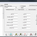
ShapeBook with 2D3DSteel application models - The Latest User Reviews

Most popular CAD downloads

VisualCAM

1.0.5.0 download

VisualART 1.0 requires the VisualCAM 1.0 base platform to be installed. If you have not installed VisualCAM 1.0 please install that first before installing VisualART 1.0. You will not be ...

TraCPlane

1.8.0-F download

This program trace on printer a sketch of your futur model from the data entered by the user for : Wing, Stabilizer, Fuselage glider ou airplane and Fin and ruder. ...

CurveExpert Basic

2.2.3 download

... be modelled using a toolbox of linear regression models, nonlinear regression models, interpolation, or splines. Over 30 models are built-in, but custom regression models may also be defined by the user. Full-featured ...

CityCAD Viewer

2.7.0 download

CityCAD Viewer application that was designed in order to help you view CityCAD native fies without having the main application installed on your system. However, CityCAD Viewer is limited to ...

GEOPoint

5.1 download

... estimates path-loss and rain-attenuation based on ITU-R climate models. As used by Hausfeld Consulting for satellite communications ... satellite at a specified frequency using ITU-R propagation models; estimate the impact of satellite motion on EIRP ...

5 award

Open3DQSAR

2.24 download

... generate and challenge the predictivity of many 3D-QSAR models using different training/test set combinations, superposition schemes, variable selection and data scrambling procedures, etc. High computational performance is attained through implementation ...

GGCad Professional Edition

2.1.0.5 download

... enable users to create, edit and manage CAD models. GGCad Free Edition is bundled with a rich collection of templates and layers, allowing you to import these into your schematics. ...

VEGA ZZ

3.2.3.28 download

VEGA ZZ is a complete molecular modelling suite that includes several features to make your research jobs very easy. This software is FREE for non-profit academic uses. Extreme OpenGL implementation ...

TexGen

3.11.0 download

... and textile composites. Adopting a straightforward approach, the application provides you with several textile options and enables ... by the Nottingham team as the basis of models for a variety of properties, including textile mechanics, ...

QGIS

3.36.1 download

QGIS is a professional GIS application that is built on top of and proud ... · Display raster data such as digital elevation models, aerial photography or landsat imagery · Change raster ...