Terra Excess 25.1217

... cut and fill volumes for Earthworks; Viewing and editing survey points. ...

Author Terra Excess Software
License Free To Try
Price $298.00
Released 2017-01-01
Downloads 98
Filesize 46.02 MB
Requirements CPU:1.5 GHz or faster, RAM: 1 GB or more, Disk space: 190 MB, Active internet connection
Installation Install and Uninstall
Keywords land surveying, civil engineering, topographic, contour lines, contour map, triangulated irregular network, earthworks, volumetric, volume calculation, cut and fill, volumes, estimating volumes, survey points, CAD, DXF, quarries, tin surface
Users' rating
(11 rating)
Terra ExcessCADWin2000, Windows XP, Windows 7 x32, Windows 7 x64, Windows 8, Windows 10, WinServer, WinOther, Windows Vista, Windows Vista x64
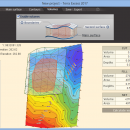
Terra Excess data editing - Download Notice

Using Terra Excess Free Download crack, warez, password, serial numbers, torrent, keygen, registration codes, key generators is illegal and your business could subject you to lawsuits and leave your operating systems without patches. We do not host any torrent files or links of Terra Excess on rapidshare.com, depositfiles.com, megaupload.com etc. All Terra Excess download links are direct Terra Excess full download from publisher site or their selected mirrors.
Avoid: data editing oem software, old version, warez, serial, torrent, Terra Excess keygen, crack.
Consider: Terra Excess full version, data editing full download, premium download, licensed copy.

Terra Excess data editing - The Latest User Reviews

Most popular CAD downloads

CADopia 23 Standard

22.3.1.4100 download

... features of previous releases of CADopia. Drawing Comparision Data Extraction Wizard Associative hatching Improved batch printing Layer ... export to Excel Multileaders Raster Image insertion and editing Clipping support for references, images, and viewports Quick ...

2D/3D cad: dwg, dxf, plt, cgm, svg, pdf

14 download

... its hidden elements and measure them when necessary. Editing. The software has a wide range of tools ... PDF to DWG conversion feature, it transforms PDF data into editable DWG entities. Other types of conversion ...

2D/3D cad: dwg, dxf, plt, cgm, svg, pdf

14 download

... its hidden elements and measure them when necessary. Editing. The software has a wide range of tools ... PDF to DWG conversion feature, it transforms PDF data into editable DWG entities. Other types of conversion ...

CADopia 23 Professional

22.3.1.4100 download

... previous releases of CADopia. Drawing Comparision Stereolithography support Data Extraction Wizard Improved batch printing Layer support in ... Palette 3D solid modeling Push & Pull for editing solid models Filleting & Chamfering solid models 2D ...

SolidFace 3D CAD PTV

24.0.0.X download

... configurations, standard content libraries, multi-part modeling and in-context editing. Import existing CAD data and use SolidFace to collaborate with a vendor. Import existing CAD data and using standard X_T, X_B, DWG, DXF, BMP ...

CADopia 23 Professional

22.3.1.4100 download

... previous releases of CADopia. Drawing Comparision Stereolithography support Data Extraction Wizard Improved batch printing Layer support in ... Palette 3D solid modeling Push & Pull for editing solid models Filleting & Chamfering solid models 2D ...

Prode Valves

1.08 download

... evaluation of valve's performance. * Connect to multiple databases to store and retrieve data, search data by different keywords and patterns, easily navigate between ... define, store and retrieve multiple configurations including language, database connecions, units of measurement, currency. * Integrates with ...

CADopia 23 Standard

22.3.1.4100 download

... features of previous releases of CADopia. Drawing Comparision Data Extraction Wizard Associative hatching Improved batch printing Layer ... export to Excel Multileaders Raster Image insertion and editing Clipping support for references, images, and viewports Quick ...

GPS Utility

5.51 download

... GPS information. You can use it to transfer data to/from a GPS receiver and store the data in PC files in one of several text ... Console. GPS Utility is particularly useful for editing and splicing together track and route segments. You ...

5 award

QGIS

3.36.1 download

... Software (FOSS). QGIS supports vector, raster, and database formats and lets you browse and create map data on your computer. QGIS supports many common spatial data formats (e.g. ESRI ShapeFile, geotiff). QGIS supports plugins ...