Thuban for Windows 1.2.2
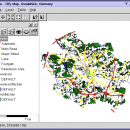
Thuban is an Interactive Geographic Data Viewer with the following features:
# Vector Data Support: Shapefile, PostGIS Layer and OGR
# Raster Data Support: GeoTIFF Layer and GDAL
# Comfortable Map Navigation
# Object Identification and Annotation
# Legend Editor and Classification
# Table Queries and Joins
# Projection Support
| Author | Thuban Development Team |
| License | Open Source |
| Price | FREE |
| Released | 2009-08-18 |
| Downloads | 203 |
| Filesize | 11.22 MB |
| Requirements | |
| Installation | Instal And Uninstall |
| Keywords | geographic data viewer, gis viewer, analyze geographic information, information, geographic, viewer |
| Users' rating (21 rating) |
Using Thuban for Windows Free Download crack, warez, password, serial numbers, torrent, keygen, registration codes,
key generators is illegal and your business could subject you to lawsuits and leave your operating systems without patches.
We do not host any torrent files or links of Thuban for Windows on rapidshare.com, depositfiles.com, megaupload.com etc.
All Thuban for Windows download links are direct Thuban for Windows full download from publisher site or their selected mirrors.
Avoid: data on map oem software, old version, warez, serial, torrent, Thuban for Windows keygen, crack.
Consider: Thuban for Windows full version, data on map full download, premium download, licensed copy.


