TNTmips 20240404

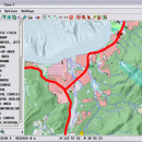
TNTmips is a geospatial image processing tool that allows you to analyze and modify ... handle desktop cartography, electronic atlas preparation and spatial database management. ...

Author MicroImages, Inc.
License Freeware
Price FREE
Released 2024-04-04
Downloads 756
Filesize 121.00 MB
Requirements
Installation Instal And Uninstall
Keywords GIS data analysis, analyze geodetic data, edit GIS dataset, GIS, dataset, editor, analysis
Users' rating
(54 rating)
TNTmipsCADWindows XP, Windows Vista, Windows Vista x64, Windows 7, Windows 7 x64, Windows 8, Windows 8 x64, Windows 10, Windows 10 x64, Windows 11
TNTmips data process - Download Notice

Using TNTmips Free Download crack, warez, password, serial numbers, torrent, keygen, registration codes, key generators is illegal and your business could subject you to lawsuits and leave your operating systems without patches. We do not host any torrent files or links of TNTmips on rapidshare.com, depositfiles.com, megaupload.com etc. All TNTmips download links are direct TNTmips full download from publisher site or their selected mirrors.
Avoid: data process oem software, old version, warez, serial, torrent, TNTmips keygen, crack.
Consider: TNTmips full version, data process full download, premium download, licensed copy.

TNTmips data process - The Latest User Reviews

Most popular CAD downloads

GreatCirc

4.2 download

... The layout is intuitive, allowing users to input data and access features without a steep learning curve. ... users. Its compatibility with other navigation tools and data formats enhances its utility, allowing users to integrate ...

5 award

NetLogo

6.0.4 download

... saved as applets and used in the educational process, while the integrated API enables developers to integrate ... and controlling agents Export and import functions (export data, save and restore state of model, make a ...

Panoply for Mac

5.4.3 download

... plots geo-gridded arrays from netCDF, HDF and GRIB datasets. Panoply is designed to help you view and process the data included in netCDF, HDF, GRIB, and other types of databases, in order to generate geo-gridded plots. Since the ...

Mathcad Prime

9.0 download

... that allow engineers to optimize their critical design processes. PTC Mathcad Prime lets you type ... Math Exploration – Display, manipulate, analyze and plot data, with full units support throughout the application, so ...

Engauge Digitizer for Mac OS X

12.0 download

... written or copied to a spreadsheet. The process starts with an image file containing a graph or map. The final result is digitized data that can be used by other tools such ...

TNTmips for Mac OS X

20240111 download

... you work with virtually any type of geospatial data including imagery, terrain surfaces, and map data with associated database attributes. It provides all the tools you need ... georeference, interpret, and publish any type of geospatial data. TNTmips provides professional geospatial tools in a single ...

DiagramStudio

6.00 download

A picture is worth a thousand words. A clear, self-explanatory, striking picture - whether it's a flowchart, diagram, illustration or technical drawing - may be worth a new contract, extra sales ...

Archicad

27 B3001 download

... the information about the building in a central database; changes made in one view are updated in all others, including floor plans, sections/elevations, 3D models and bills of material * ...

PowerStar

5.22 download

... other properties. Mouseover any symbol to display electrical data. Highlight devices with overcurrent, kVA/kW overload, over/undervoltage. Print or plot to any Windows compatible printer or plotter. Circuit report format compatible ...

5 award

DataScene Deluxe

3.2.3.9 download

DataScene is a data graphing, animation, and analysis software package. It allows ... Ploar, and more) with scientific, financial, and statistical data, to manipulate, print, and export high quality graphs. DataScene can also help you analyze data with a ...

5 award