Panoply for Mac 5.4.3

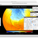
... user to plot raster image. Depending on the data, it can draw global longitude-latitude images or pole-to-pole ... plots geo-gridded arrays from netCDF, HDF and GRIB datasets. The utility can also combine two arrays and can project the analysis using more than 100 maps. ...

Author Robert B. Schmunk
License Freeware
Price FREE
Released 2024-06-24
Downloads 254
Filesize 36.40 MB
Requirements
Installation Instal And Uninstall
Keywords plot raster image, longitude image, pole-to-pole image, raster image, rasterize, raster
Users' rating
(24 rating)
Panoply for MacCADMac OS X
Panoply for Mac data view - Download Notice

Using Panoply for Mac Free Download crack, warez, password, serial numbers, torrent, keygen, registration codes, key generators is illegal and your business could subject you to lawsuits and leave your operating systems without patches. We do not host any torrent files or links of Panoply for Mac on rapidshare.com, depositfiles.com, megaupload.com etc. All Panoply for Mac download links are direct Panoply for Mac full download from publisher site or their selected mirrors.
Avoid: data view oem software, old version, warez, serial, torrent, Panoply for Mac keygen, crack.
Consider: Panoply for Mac full version, data view full download, premium download, licensed copy.

Panoply for Mac data view - The Latest User Reviews

Most popular CAD downloads

GEOPoint

5.1 download

... an easy to use dialog-style user interface for data entry and calculation; entry of earth station location ... and elevation contours to a KML file for viewing in Google Earth. estimation of site altitude from ...

5 award

NetLogo

6.0.4 download

... or multiple variables, which you can adjust to view the results. For instance, climate change hinges on ... and controlling agents Export and import functions (export data, save and restore state of model, make a ...

CrystalMaker

11.1.0 download

... workflow that majors on productivity: just drag-and-drop your data files into the program for instant display in ... structures in real time, with the mouse. Multiple View "bookmarks" and undo levels encourage exploration and discovery ...

CrystalMaker for Mac OS X

11.1.0 download

... workflow that majors on productivity: just drag-and-drop your data files into the program for instant display in ... structures in real time, with the mouse. Multiple View "bookmarks" and undo levels encourage exploration and discovery ...

TNTatlas

2024 B20240606 download

TNTatlas is a powerful free geodata viewer that lets you publish and distribute your maps and geospatial data — from a single geodata file to complex ... rapidly assemble and distribute existing electronic map and database materials for those working in natural disaster relief, ...

MarvinSketch

23.16.0 download

... bonds user can assign stereochemistry to atoms. Additional data fields can also be attached to atoms, via ... Chemical structure drawing Molecular modeling Tune, combine and view Predictors and enumerators Structure and valence checker Working ...

TNTatlas for Mac OS X

2024 B20240508 download

TNTatlas is a powerful free geodata viewer that lets you publish and distribute your maps and geospatial data — from a single geodata file to complex ... rapidly assemble and distribute existing electronic map and database materials for those working in natural disaster relief, ...

Panoply for Mac

5.4.3 download

... plots geo-gridded arrays from netCDF, HDF and GRIB datasets. Panoply is designed to help you view and process the data included in netCDF, HDF, GRIB, and other types of databases, in order to generate geo-gridded plots. Since the ...

MountainsMap Scanning Topography

6.2.6266 download

... be able to easily analyze measurements and metrology data. It features an extensive set of surface texture ... incremental optional modules for advanced applications. Analyzes measurement data in accordance with the latest standards and methods. ...

Thuban for Mac OS X

1.0.1-3 download

Thuban is an interactive geographic data viewer (GIS viewer) which features methods to visualize, explore, and analyze geographic information. Thuban is an Interactive Geographic Data Viewer with the following features: # Vector ...