Mini CAD Viewer 3.7.0.0
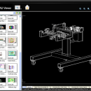
Mini CAD Viewer is a compact free CAD viewer.It is designed to be easy to use, even ... allows you to move and zoom in/out drawing view at will. It carries "thumbnail" view, which allows users quickly perform search on task folders. It supports DWG, DWF, DXF formats. It allows drawing file to be printed. ...
| Author | zxt2007.com |
| License | Freeware |
| Price | FREE |
| Released | 2025-02-20 |
| Downloads | 849 |
| Filesize | 20.65 MB |
| Requirements | |
| Installation | Install and Uninstall |
| Keywords | CAD viewer, AutoCAD viewer, DWG viewer, DXF viewer |
| Users' rating (10 rating) |
Using Mini CAD Viewer Free Download crack, warez, password, serial numbers, torrent, keygen, registration codes,
key generators is illegal and your business could subject you to lawsuits and leave your operating systems without patches.
We do not host any torrent files or links of Mini CAD Viewer on rapidshare.com, depositfiles.com, megaupload.com etc.
All Mini CAD Viewer download links are direct Mini CAD Viewer full download from publisher site or their selected mirrors.
Avoid: dxf view oem software, old version, warez, serial, torrent, Mini CAD Viewer keygen, crack.
Consider: Mini CAD Viewer full version, dxf view full download, premium download, licensed copy.


