PreviSat 6.1.0.3

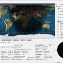
PreviSat is a satellite tracking program designed for observing purposes. PreviSat enables you to manage TLE orbital elements by updating the categories of orbital elements from the Internet and uploading data from TXT, TLE, or GZ file format. PreviSat is able to make predictions of their passes and also Iridium flares. ...

Author Astropedia
License Open Source
Price FREE
Released 2023-11-13
Downloads 452
Filesize 23.20 MB
Requirements
Installation Instal And Uninstall
Keywords track satellite, satellite tracker, satellite position, track, tracker, position
Users' rating
(11 rating)
PreviSatCADWindows XP, Windows Vista, Windows Vista x64, Windows 7, Windows 7 x64, Windows 8, Windows 8 x64, Windows 10, Windows 10 x64, Windows 11
PreviSat earth - Download Notice

Using PreviSat Free Download crack, warez, password, serial numbers, torrent, keygen, registration codes, key generators is illegal and your business could subject you to lawsuits and leave your operating systems without patches. We do not host any torrent files or links of PreviSat on rapidshare.com, depositfiles.com, megaupload.com etc. All PreviSat download links are direct PreviSat full download from publisher site or their selected mirrors.
Avoid: earth oem software, old version, warez, serial, torrent, PreviSat keygen, crack.
Consider: PreviSat full version, earth full download, premium download, licensed copy.

PreviSat earth - The Latest User Reviews

Most popular CAD downloads

TrueSpace

7.61 download

... content for online shared spaces, and for Virtual Earth. Features: Export to Virtual Earth and X format: · An entirely re-written X ... · Also included is an export to Virtual Earth which will let you place your 3D creations ...

Mobile Atlas Creator for Mac OS X

2.2.1 download

... - KMZ (GPS handhelds) Glopus (Pocket PC) Google Earth GPS Sport Tracker Magellan RMP (GPS handhelds) & VantagePoint Maplorer (Windows CE/Windows Mobile) Maverick (Android) Mobile Trail Explorer (J2ME) - single ...

GEOPoint

5.1 download

... pointing angles from a given location on the earth towards a specified geostationary satellite. The program also ... interface for data entry and calculation; entry of earth station location coordinates directly, or by clicking on ...

5 award

GreatCirc

4.2 download

... of plotting and analyzing flight paths over the Earth's surface. **User Interface and Experience** GreatCirc ... as it provides the shortest path over the Earth's surface. The software supports a variety of coordinate ...

5 award

Elshayal Smart

23.02 download

... commercial software package. Download Maps from Google Earth, and Trace & save GPS route and View and Rectify Raster Images gif, jpg, bmp and Edit shape files, build new ...

Energy2D for Mac OS X

2.6 download

... may be useful in teaching energy concepts in Earth science, physics, and engineering. Energy2D runs with any web browser on Windows (XP, Vista, and Windows 7), Mac OS X, ...

LeanWall

1.10.40 download

... begins from the initial dimensioning of the wall, earth surface and water levels by clicking on the given dimensions. Next is inputting material properties of the wall, soil, water and ...

PowerNet

5.32 download

... ground fault. Include motor contribution to fault. Show earth current, fault R/X ratio, RMS and peak fault current. Mouse-over display of device electrical data. Mouse-over display of voltage and current ...

5 award

Energy2D

2.6 download

... may be useful in teaching energy concepts in Earth science, physics, and engineering. Energy2D runs with any web browser on Windows (XP, Vista, and Windows 7), Mac OS X, ...

GeoMapApp

3.7.1 download

... the Marine Geoscience Data System (MGDS) at Lamont-Doherty Earth Observatory of Columbia University. ...