Easy CAD Converter 3.1

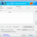
Easy CAD Converter, previously known as DXF DWG DWF ... to DWG without the need for AutoCAD-based products. Easy CAD Converter is more than a file format converter, and you can even upgrade or downgrade your DWG, DXF, DWF drawing files to a newer or earlier version to answer your specific needs. ...

Author Benzsoft
License Free To Try
Price $89.00
Released 2014-12-01
Downloads 427
Filesize 4.33 MB
Requirements AutoCAD not required
Installation Install and Uninstall
Keywords DWG to DXF, DWG to DWF, DXF to DWG, DXF to DWF, DWF to DXF, DWF to DWG, DWG2DXF, DWG2DWF, DXF2DWG, DXF2DWF, DWF2DXF, DWF2DWG, converter, convert, conversion
Users' rating
(18 rating)
Easy CAD ConverterCADWin8 x32, Win8 x64, Win2000, Windows 7 x32, Windows 7 x64, WinServer, Windows Vista, Windows Vista x64, Windows XP, Windows 10
Easy CAD Converter easy file - Download Notice

Using Easy CAD Converter Free Download crack, warez, password, serial numbers, torrent, keygen, registration codes, key generators is illegal and your business could subject you to lawsuits and leave your operating systems without patches. We do not host any torrent files or links of Easy CAD Converter on rapidshare.com, depositfiles.com, megaupload.com etc. All Easy CAD Converter download links are direct Easy CAD Converter full download from publisher site or their selected mirrors.
Avoid: easy file oem software, old version, warez, serial, torrent, Easy CAD Converter keygen, crack.
Consider: Easy CAD Converter full version, easy file full download, premium download, licensed copy.

Easy CAD Converter easy file - The Latest User Reviews

Most popular CAD downloads

GardenBox 3D

8.0 download

... blueprint plan image (a scanned drawing or digital file) for precise replication or start entirely from scratch. Effortlessly drag and drop elements – plants, trees, furniture, buildings – onto your ...

TurboCAD Deluxe

2016 download

... expanded computer memory to load, process, and render files of nearly any size, while extensive file support including DWG, DXF, SKP, new STL and more make it easy to share your work. It's everything you need ...

OpenDCL Studio

9.1.5.2 download

OpenDCL is a handy, easy-to-use and accessible insturment that is specially designed for AutoLISP programmers that want to replace AutoCAD's limited DCL. They can replace the Dialog Control Language ...

TNTatlas for Mac OS X

2024 B20240508 download

... and geospatial data — from a single geodata file to complex map layouts prepared using TNTmips. TNTatlas ... massive sized geodata and will directly display numerous file formats including shapefiles, GeoTIFF, JP2, PNG, MrSID, DXF, ...

2D DXF DWG CGM SVG HPGL Import DLL

9 download

... where it is necessary to work with CAD file formats such as AutoCAD DWG, DXF, DWF, Hewlett-Packard ... HPGL, HPGL-2, CGM, SVG and others) - provides easy access to the properties of CAD entities - ...

VeryUtils DWG to SVG Converter Command Line

2.7 download

... Command Line allows you convert DWG and DXF files to PDF and SVG files directly without need of AutoCAD, it converts DWG and DXF files into vector SVG files, quick and easily. DWG ...

CAD Import .NET for Compact Framework

1 download

... small API for AutoCAD DWG manipulation and DXF file formats in C#, VB.NET and other .NET programming ... entities, using SHX fonts for DWG and DXF file format. Here are some key features of "CAD ...

Easy CAD to Image Converter

3.2 download

Easy CAD to Image Converter supports conversion from DWG, ... to BMP, JPEG, GIF, TIFF, PNG, and TGA file types. Easy CAD to Image Converter is more than a file format converter, and you can even batch render ...

VeryUtils DWG to Image Converter Command Line

2.7 download

... be used to batch convert DWG and DXF files to TIF (TIFF), JPG (JPEG), BMP, GIF, PNG, ... Allows you to convert your drawings into image files easily without purchasing expensive software programs. VeryUtils DWG ...

TNTatlas

2024 B20240606 download

... and geospatial data — from a single geodata file to complex map layouts prepared using TNTmips. TNTatlas ... massive sized geodata and will directly display numerous file formats including shapefiles, GeoTIFF, JP2, PNG, MrSID, DXF, ...