Panoply for Mac 5.4.3

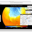
... an utility that enable user to plot raster image. Depending on the data, it can draw global longitude-latitude images or pole-to-pole latitude-vertical images.Panoply is a cross-platform application which plots geo-gridded arrays from netCDF, HDF and GRIB datasets. The utility can also combine two arrays and can project the analysis using more than 100 maps. ...

Author Robert B. Schmunk
License Freeware
Price FREE
Released 2024-06-24
Downloads 262
Filesize 36.40 MB
Requirements
Installation Instal And Uninstall
Keywords plot raster image, longitude image, pole-to-pole image, raster image, rasterize, raster
Users' rating
(24 rating)
Panoply for MacCADMac OS X
Panoply for Mac export image files - Download Notice

Using Panoply for Mac Free Download crack, warez, password, serial numbers, torrent, keygen, registration codes, key generators is illegal and your business could subject you to lawsuits and leave your operating systems without patches. We do not host any torrent files or links of Panoply for Mac on rapidshare.com, depositfiles.com, megaupload.com etc. All Panoply for Mac download links are direct Panoply for Mac full download from publisher site or their selected mirrors.
Avoid: export image files oem software, old version, warez, serial, torrent, Panoply for Mac keygen, crack.
Consider: Panoply for Mac full version, export image files full download, premium download, licensed copy.

Panoply for Mac export image files - The Latest User Reviews

Most popular CAD downloads

Panoply for Mac

5.4.3 download

... to disk GIF, JPEG, PNG or TIFF bitmap images or as PDF or PostScript graphics files. Export lon-lat map plots in KMZ format. Export animations as MP4 video or as a collection ...

Easy CAD Viewer

3.3 download

... CAD Viewer works with AutoCAD DWG, DXF, DWF files of all versions as early as AutoCAD Release ... viewer; it converts DWG, DXF, DWF drawings to image formats such as BMP, JPG, GIF, PNG, TIFF, ...

MagicPlot Viewer for Mac OS X

2.0 download

... for viewing plots and thumbnails from multiple text/ASCII files. Plotvisor's appearance is similar to that of popular image viewers: there is the directory tree, thumbnails and ... the plot you need in a mass of files. Discuss your results with colleagues using fullscreen ...

VEGA ZZ

3.2.3.28 download

... PDBQT multi-model formats. Snapshot, hardware and software image rendering with the capability to create images bigger than the monitor size. The software rendering ... Vector graphic rendering engine. It's possible to export the view in LaTex, PostScript, Encapsulated PostScript, PDF, ...

CADopia 23 Standard

22.3.1.4100 download

... DWG conversion, voice notes, and support for DGN files as underlays in addition to all standard drawing ... are: Powerful CAD functionality: AutoCAD 2.5-2018 DWG Support Export Adobe Acrobat (PDF) files from your drawings Import ...

TinyCAD

3.00.04 download

... Turn your circuit diagrams in to PNG images Although you might want to put the ... bitmap. TinyCAD supports outputing ciruits diagrams as PNG files. If you are not familar with PNG files, ...

Easy CAD to Image Converter

3.2 download

Easy CAD to Image Converter supports conversion from DWG, DXF, DWF to ... PNG, and TGA file types. Easy CAD to Image Converter is more than a file format converter, ... even batch render your DWG, DXF, DWF drawing files to image files of any size to answer ...

Digimizer

6.4.0 download

Digimizer is an easy-to-use and flexible image analysis software package that allows precise manual measurements ... GIF, TIFF, BMP, PNG, WMF, EMF and DICOM files. Images can be rotated, flipped or straightened. ...

GedScape

3.0.01 download

... browsing, manipulating, converting and extracting data from GEDCOM files. It is the ideal GEDCOM viewer and converter, ... all data for individuals and families within GEDCOM files, including photos, citations and notes with a simple, ...

GPS Utility

5.51 download

... GPS receiver and store the data in PC files in one of several text formats. The ... map and add map annotations in text or image form. GPS Utility can also be set ...

5 award