TNTatlas for Mac OS X 2024 B20240508

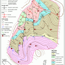
TNTatlas is a powerful free geodata viewer that lets you publish and distribute your maps and geospatial data — from a single geodata file to complex map layouts prepared using TNTmips. TNTatlas ... massive sized geodata and will directly display numerous file formats including shapefiles, GeoTIFF, JP2, PNG, MrSID, DXF, and DWG. ...

Author MicroImages, Inc.
License Freeware
Price FREE
Released 2024-05-08
Downloads 428
Filesize 87.90 MB
Requirements Mac OS 13+
Installation Instal And Uninstall
Keywords geospatial viewer, view atlas, visualize geospatial data, atlas, map, viewer
Users' rating
(41 rating)
TNTatlas for Mac OS XCADMac OS X
TNTatlas for Mac OS X free file viewer - Download Notice

Using TNTatlas for Mac OS X Free Download crack, warez, password, serial numbers, torrent, keygen, registration codes, key generators is illegal and your business could subject you to lawsuits and leave your operating systems without patches. We do not host any torrent files or links of TNTatlas for Mac OS X on rapidshare.com, depositfiles.com, megaupload.com etc. All TNTatlas for Mac OS X download links are direct TNTatlas for Mac OS X full download from publisher site or their selected mirrors.
Avoid: free file viewer oem software, old version, warez, serial, torrent, TNTatlas for Mac OS X keygen, crack.
Consider: TNTatlas for Mac OS X full version, free file viewer full download, premium download, licensed copy.

TNTatlas for Mac OS X free file viewer - The Latest User Reviews

Most popular CAD downloads

Mini CAD Viewer

3.7.0.0 download

Mini CAD Viewer is a compact free CAD viewer.It is designed to be easy to use, even ... supports DWG, DWF, DXF formats. It allows drawing file to be printed. ...

MicroDicom

2024.2 download

... It also has the advantage of being free for use and accessible to everyone. It ... *.bmp, *.gif, etc) Open and save DICOM directory files Display of patient list from DICOMDIR Display images ...

MicroDicom x64

2024.2 download

... It also has the advantage of being free for use and accessible to everyone. It ... *.bmp, *.gif, etc) Open and save DICOM directory files Display of patient list from DICOMDIR Display images ...

GGCad Professional Edition

2.1.0.5 download

... to create, edit and manage CAD models. GGCad Free Edition is bundled with a rich collection of ... export drawings to PDF/DXF format. GGCad support 3D file formats such as STL, 3DS, Collada. It can ...

QGIS

3.36.1 download

... on top of and proud to be itself Free and Open Source Software (FOSS). QGIS supports ... initial goal was to provide a GIS data viewer. QGIS has reached that point in its evolution ...

Portable MicroDicom x64

2024.2 download

... It also has the advantage of being free for use and accessible to everyone. It ... *.bmp, *.gif, etc) Open and save DICOM directory files Display of patient list from DICOMDIR Display images ...

Br3D

1.3 download

Light weight, fast free 3D ViewerLight weight, fast free 3D Viewer Supports various 3D file format. Read : DWG, DXF, IFC, IFCZIP, STL, ... Background Color General Option For Saving As Image File Association ...

TNTatlas

2024 B20240606 download

TNTatlas is a powerful free geodata viewer that lets you publish and distribute your maps and geospatial data — from a single geodata file to complex map layouts prepared using TNTmips. TNTatlas ...

VariCAD Viewer for Linux

2024 2.01 download

VariCAD Viewer is a free viewer, convertor and printing software working with 2D DWG, DXF, 3D STEP and 2D/3D VariCAD file formats. VariCAD viewer allows you to convert DWG to DXF and ...

CARIS Easy View

4.2.13 download

... view spatial data imported from numerous types of files. It allows you to load multiple layers, change ... object parameters. View your spatial data using the free CARIS viewer. CARIS Easy View allows users to ...