Thuban for Linux 1.2.2

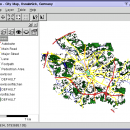
Thuban is an Interactive Geographic Data Viewer with the following features:

# Vector Data Support: Shapefile, PostGIS Layer and OGR
# Raster Data Support: GeoTIFF Layer and GDAL
# Comfortable Map Navigation
# Object Identification and Annotation
# Legend Editor and Classification
# Table Queries and Joins
# Projection Support
# Printing and Vector Export
# API for Add-Ons (Extensions) ...

Author Thuban Development Team
License Open Source
Price FREE
Released 2009-08-18
Downloads 220
Filesize 1.18 MB
Requirements
Installation Instal And Uninstall
Keywords geographic data viewer, gis viewer, analyze geographic information, information, geographic, viewer
Users' rating
(23 rating)
Thuban for LinuxCADLinux
Thuban for Linux g d g software team - Download Notice

Using Thuban for Linux Free Download crack, warez, password, serial numbers, torrent, keygen, registration codes, key generators is illegal and your business could subject you to lawsuits and leave your operating systems without patches. We do not host any torrent files or links of Thuban for Linux on rapidshare.com, depositfiles.com, megaupload.com etc. All Thuban for Linux download links are direct Thuban for Linux full download from publisher site or their selected mirrors.
Avoid: g d g software team oem software, old version, warez, serial, torrent, Thuban for Linux keygen, crack.
Consider: Thuban for Linux full version, g d g software team full download, premium download, licensed copy.

Thuban for Linux g d g software team - The Latest User Reviews

Most popular CAD downloads

Thuban for Linux

1.2.2 download

... The FreeGIS Project provides an overview of Free Software GIS projects. Many valuable and highly sophisticated tools ... Thuban makes use of several Free GIS Software components and is itself the basis of advanced ...

Elshayal Smart

23.02 download

Elshayal Smart is the first Arabian GIS software that is completely developed by Arabian developers team and independent of any commercial software package. Download Maps from Google Earth, and

ZW3D

2020 download

... that previously required standalone CAD and standalone CAM software. The integrated system makes it easier to manage ... Easy to Learn and Use ZW3D ensures fast software implementation and shortens the learning curve with MS ...

Aku Shaper

2.3.0 download

... Aku Shaper is an efficient and user friendly software solution that can assist users in designing their ... wide, the Aku Shaper (formerly APS3000) surfboard design software is the standard computer aided surfboard design software. ...

Integrated Genome Browser

7.0.4 B15225 download

... (IGB, pronounced Ig-Bee) is an interactive, zoomable, scrollable software program you can use to visualize and explore ... start out that way. Initial development of the software was largely funded by Affymetrix, Inc., which donated ...

CADEMIA for Mac

3.0 RC3 download

Existing software tools for the planning process have severe limitations: ... purposes it is now available as open source software for the practitioner. A long time experience in ... serves as an inexpensive alternative to proprietary CAD software. A small core-developer team constantly improves the ...

Thuban for Mac OS X

1.0.1-3 download

... The FreeGIS Project provides an overview of Free Software GIS projects. Many valuable and highly sophisticated tools ... Thuban makes use of several Free GIS Software components and is itself the basis of advanced ...

OpalCalc Portable

1.94 download

... many bugs, but it turned out the Soulver team made great strides in developing a version for ... to Aqualia for creating a wonderful piece of software, but I couldn't wait for a Windows port, ...

KMWin

1.52 download

KMWin (Kaplan-Meier for Windows) is a convenient tool for graphical presentation of results from Kaplan-Meier survival time analysis. The programme is an interface and intended to make working with R easier. ...

VectorWorks

2017 SP3 download

... product. Communicating and collaborating with your team across the design process has never been so ... and it will be their first version of software to support point cloud data. ...