RoboGEO 6.3.2

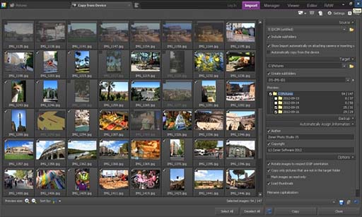
Geotag digital images with latitude, longitude, altitude, and direction information. RoboGEO stamps this information onto the actual photo or writes it to the EXIF headers. In addition, RoboGEO allows you to permanently geotag and link your photos to the GPS coordinates. ...

Author Pretek, Inc.
License Demo
Price $79.95
Released 2012-02-27
Downloads 1168
Filesize 13.40 MB
Requirements
Installation Instal And Uninstall
Keywords georeference image, geotag, reference, geocode
Users' rating
(16 rating)
RoboGEOEditorsWindows XP, Windows Vista, Windows Vista x64, Windows 7, Windows 7 x64, Windows 8, Windows 8 x64, Windows 10, Windows 10 x64
RoboGEO google maps software - Download Notice

Using RoboGEO Free Download crack, warez, password, serial numbers, torrent, keygen, registration codes, key generators is illegal and your business could subject you to lawsuits and leave your operating systems without patches. We do not host any torrent files or links of RoboGEO on rapidshare.com, depositfiles.com, megaupload.com etc. All RoboGEO download links are direct RoboGEO full download from publisher site or their selected mirrors.
Avoid: google maps software oem software, old version, warez, serial, torrent, RoboGEO keygen, crack.
Consider: RoboGEO full version, google maps software full download, premium download, licensed copy.

RoboGEO google maps software - The Latest User Reviews

Most popular Editors downloads

Tourweaver7.80 Professional for Win

7.80 download

Tourweaver, virtual tour software, is used to create professional 360 full virtual ... dedicated to developing the most professional virtual tour software. On the basis of original features, such as ... JpegXR, an exclusive feature in latest virtual tour software of Easypano, improves loading speed of online virtual ...

Tourweaver7.90 Standard for Win

7.90 download

Tourweaver, virtual tour software, is used to create professional 360 full virtual ... dedicated to developing the most professional virtual tour software. On the basis of original features, such as ... JpegXR, an exclusive feature in latest virtual tour software of Easypano, improves loading speed of online virtual ...

RoboGEO

6.3.2 download

... metadata) are preserved. Includes a Picasa-style geotagger for Google Earth. ...

HoudahGeo

6.4.3 download

... image files. Export the project for viewing in Google Earth, Google My Maps, or FLickr. Feature highlights: * Write GPS data, ... when places information has been updated * Create Google Earth KML and KMZ files. View photos pinned ...

Realtime Landscaping Architect 2013

5.14 download

... 2013 is a powerful, yet user-friendly landscape design software designed for landscape professionals. New users can produce professional quality designs quickly and find that the software often pays for itself with the first job. ...

Tourweaver7.80 Standard for Win

7.80 download

Tourweaver, virtual tour software, is used to create professional 360 full virtual ... dedicated to developing the most professional virtual tour software. On the basis of original features, such as ... JpegXR, an exclusive feature in latest virtual tour software of Easypano, improves loading speed of online virtual ...

Tourweaver7.90 Professional for Win

7.90 download

Tourweaver, virtual tour software, is used to create professional 360 full virtual ... dedicated to developing the most professional virtual tour software. On the basis of original features, such as ... JpegXR, an exclusive feature in latest virtual tour software of Easypano, improves loading speed of online virtual ...

Realtime Landscaping Plus 2013

8.14 download

Use Realtime Landscaping Plus 2013 landscape design software to create realistic 3D and photo-based landscape designs. This award-winning software is perfect for homeowners wanting to create their ... animation and movement path. Import your property with Google maps using our new wizard. Walk through your ...

Realtime Landscaping Plus 2014

9.02 download

... satellite view of your residence using the new Google Maps Import Wizard. No prior CAD or design experience ...