- Software
- - Graphic Apps
- - Other
- - ATOM GPS
ATOM GPS 1.0.5
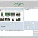
Atom GPS freeware easily geotags your photos directly from your GPS device or track log. By simply connecting your GPS Device to Atom GPS and selecting your photos you can add their geolocation in one click. By Geotagging your photos you can sort them by geographic location for easy browsing, and ...
| Author | VSO-Software |
| License | Freeware |
| Price | FREE |
| Released | 2009-08-27 |
| Downloads | 440 |
| Filesize | 7.58 MB |
| Requirements | |
| Installation | Install and Uninstall |
| Keywords | geotagging, geolocation, kml, gpx, gps software, track log, geotag, gps devives, gps, google earth, exif |
| Users' rating (18 rating) |
Using ATOM GPS Free Download crack, warez, password, serial numbers, torrent, keygen, registration codes,
key generators is illegal and your business could subject you to lawsuits and leave your operating systems without patches.
We do not host any torrent files or links of ATOM GPS on rapidshare.com, depositfiles.com, megaupload.com etc.
All ATOM GPS download links are direct ATOM GPS full download from publisher site or their selected mirrors.
Avoid: gps data oem software, old version, warez, serial, torrent, ATOM GPS keygen, crack.
Consider: ATOM GPS full version, gps data full download, premium download, licensed copy.