TNTmips for Mac OS X 20240111

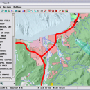
TNTmips is a geospatial image processing tool that allows you to analyze and modify GIS images. It is a professional application that can handle desktop cartography, electronic atlas preparation and spatial database management. ...

Author MicroImages, Inc.
License Freeware
Price FREE
Released 2024-01-11
Downloads 239
Filesize 87.90 MB
Requirements Mac (OS 10.8 to 11), XQuartz 2.7.9 needed (2.7.11 with manual modification)
Installation Instal And Uninstall
Keywords GIS data analysis, analyze geodetic data, edit GIS dataset, GIS, dataset, editor, analysis, mac os, TNTmips for mac, TNTgis for mac, TNTedit
Users' rating
(45 rating)
TNTmips for Mac OS XCADMac OS X
TNTmips for Mac OS X image analysis software - Download Notice

Using TNTmips for Mac OS X Free Download crack, warez, password, serial numbers, torrent, keygen, registration codes, key generators is illegal and your business could subject you to lawsuits and leave your operating systems without patches. We do not host any torrent files or links of TNTmips for Mac OS X on rapidshare.com, depositfiles.com, megaupload.com etc. All TNTmips for Mac OS X download links are direct TNTmips for Mac OS X full download from publisher site or their selected mirrors.
Avoid: image analysis software oem software, old version, warez, serial, torrent, TNTmips for Mac OS X keygen, crack.
Consider: TNTmips for Mac OS X full version, image analysis software full download, premium download, licensed copy.

TNTmips for Mac OS X image analysis software - The Latest User Reviews

Most popular CAD downloads

Geneious PRO for Vista

4.7.6 download

Geneious Pro is an integrated, cross-platform bioinformatics software suite for manipulating, finding, sharing, and exploring biological ... publications, etc. It features sequence alignment and phylogenetic analysis, contig assembly, primer design and cloning, access to ...

Digimizer

6.4.0 download

Digimizer is an easy-to-use and flexible image analysis software package that allows precise manual measurements as well ... BMP, PNG, WMF, EMF and DICOM files. Images can be rotated, flipped or straightened. Image brightness ...

Gwyddion for Linux

2.66 download

... for SPM (scanning probe microscopy) data visualization and analysis. Primarily it is intended for analysis of height fields obtained by scanning probe microscopy ... generally used for any other height field and image analysis, for instance for analysis of profilometry data ...

Kst

2.0.8 download

... interested in some benchmarks) and has built-in data analysis functionality. Kst is very user-friendly (both the community ... for three-dimensional data, as well as matrix and image support. · Monitoring of events and notifications support. ...

Kst for Mac OS X

2.0.7 download

... interested in some benchmarks) and has built-in data analysis functionality. Kst is very user-friendly (both the community ... for three-dimensional data, as well as matrix and image support. · Monitoring of events and notifications support. ...

Kst for Linux

2.0.7 download

... interested in some benchmarks) and has built-in data analysis functionality. Kst is very user-friendly (both the community ... for three-dimensional data, as well as matrix and image support. · Monitoring of events and notifications support. ...

Dagra

2.0.19152.0601 download

... accurately digitize numerical data from scanned or graphical images. Add-ins for common analysis tools get you working quickly with the new ... but to use those results in your own analysis, you'll want the underlying numerical data. Your analysis ...

TNTmips

20240404 download

TNTmips software is a complete Geographic Information System (GIS) that ... with virtually any type of geospatial data including imagery, terrain surfaces, and map data with associated database ... without importing. Overlay your geodata on Bing Maps imagery and maps or on geodata layers published on ...

CADbro

2020 download

... Feature Control Symbol, Surface Finish Symbol Label, Text, Image Balloon Advanced Analysis With diversified query & analysis tools in CADbro, you can verify the manufacturability ... cost and save the time. Key features of Analysis: Mass Properties, such as volume, area, mass Draft ...

TNTmips for Mac OS X

20240111 download

... with virtually any type of geospatial data including imagery, terrain surfaces, and map data with associated database ... without importing. Overlay your geodata on Bing Maps imagery and maps or on geodata layers published on ...