Panoply for Mac 5.4.3

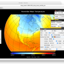
Panoply for Mac is an utility that enable user to plot raster image. Depending on the data, it can draw global longitude-latitude images or pole-to-pole latitude-vertical images.Panoply is a cross-platform application which plots geo-gridded arrays from netCDF, HDF and GRIB datasets. The utility can also combine two arrays and can project the analysis using more than 100 maps. ...

Author Robert B. Schmunk
License Freeware
Price FREE
Released 2024-06-24
Downloads 293
Filesize 36.40 MB
Requirements
Installation Instal And Uninstall
Keywords plot raster image, longitude image, pole-to-pole image, raster image, rasterize, raster
Users' rating
(28 rating)
Panoply for MacCADMac OS X
Panoply for Mac mac b - Download Notice

Using Panoply for Mac Free Download crack, warez, password, serial numbers, torrent, keygen, registration codes, key generators is illegal and your business could subject you to lawsuits and leave your operating systems without patches. We do not host any torrent files or links of Panoply for Mac on rapidshare.com, depositfiles.com, megaupload.com etc. All Panoply for Mac download links are direct Panoply for Mac full download from publisher site or their selected mirrors.
Avoid: mac b oem software, old version, warez, serial, torrent, Panoply for Mac keygen, crack.
Consider: Panoply for Mac full version, mac b full download, premium download, licensed copy.

Panoply for Mac mac b - The Latest User Reviews

Most popular CAD downloads

TNTatlas for Mac OS X

2024 B20240508 download

TNTatlas is a powerful free geodata viewer that lets you publish and distribute your maps and geospatial data — from a single geodata file to complex map layouts prepared using TNTmips. ...

CrystalMaker for Mac OS X

11.1.0 download

CrystalMaker provides a streamlined workflow that majors on productivity: just drag-and-drop your data files into the program for instant display in spectacular photo-realistic colour. Manipulate structures in real time, with the ...

CST CAD Navigator for macOS

1 download

CST CAD Navigator is an easy-to-use CAD software compatible with Windows, macOS, and Linux. It enables to open and convert different 2D drawings and 3D models, get their dimensions and create ...

TNTmips for Mac OS X

20240111 download

TNTmips for Mac is a complete Geographic Information System (GIS) that lets you work with virtually any type of geospatial data including imagery, terrain surfaces, and map data with associated ...

EnCalc

4.2 download

... Server 2008, 2012, 2016, & 2019) Compatible with Mac OS X Yosemite (10.10.5) to the latest MacOS ... prefs file (Loans, etc.) with other Windows and Mac computers Updated! User Interface received a complete overhaul ...

Panoply for Mac

5.4.3 download

Panoply for Mac is a cross-platform application which plots geo-gridded arrays from netCDF, HDF and GRIB datasets. Panoply is designed to help you view and process the data included in ...

Mobile Atlas Creator for Mac OS X

2.2.1 download

Mobile Atlas Creator (formerly known as TrekBuddy Atlas Creator) is an open source (GPL) program which creates offline atlases for GPS handhelds and cell phone applications like TrekBuddy, AndNav and other ...

jHepWork

31.1 download

... is installed. It was fully tested on Windows, Mac, Linux and any hardware, such as desktops, laptops, netbooks, production servers. It can run in either a GUI-driven mode, or a ...

5 award

Noble Ape Simulation

0.698 download

The Noble Ape Simulation has been open source from the start. The source code for the current Noble Ape Simulation has been online under continuous development since 2000. It represents an ...

GedScape for MAC OS X

3.0.01 download

GedScape is a software utility for browsing, manipulating, converting and extracting data from GEDCOM files. It is the ideal GEDCOM viewer and converter, an essential tool for genealogists. Features: Easily ...