TNTmips for Mac OS X 20240111

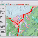
... and modify GIS images. It is a professional application that can handle desktop cartography, electronic atlas preparation and spatial database management. ...

Author MicroImages, Inc.
License Freeware
Price FREE
Released 2024-01-11
Downloads 242
Filesize 87.90 MB
Requirements Mac (OS 10.8 to 11), XQuartz 2.7.9 needed (2.7.11 with manual modification)
Installation Instal And Uninstall
Keywords GIS data analysis, analyze geodetic data, edit GIS dataset, GIS, dataset, editor, analysis, mac os, TNTmips for mac, TNTgis for mac, TNTedit
Users' rating
(45 rating)
TNTmips for Mac OS XCADMac OS X
TNTmips for Mac OS X map application - Download Notice

Using TNTmips for Mac OS X Free Download crack, warez, password, serial numbers, torrent, keygen, registration codes, key generators is illegal and your business could subject you to lawsuits and leave your operating systems without patches. We do not host any torrent files or links of TNTmips for Mac OS X on rapidshare.com, depositfiles.com, megaupload.com etc. All TNTmips for Mac OS X download links are direct TNTmips for Mac OS X full download from publisher site or their selected mirrors.
Avoid: map application oem software, old version, warez, serial, torrent, TNTmips for Mac OS X keygen, crack.
Consider: TNTmips for Mac OS X full version, map application full download, premium download, licensed copy.

TNTmips for Mac OS X map application - The Latest User Reviews

Most popular CAD downloads

SoundStepper

5.4.1.304 download

... telescope control, such as for example a sky map, autoguiding, or capture images from a webcam or ... the computer with planetarium, photo/video capture and others applications, in Windows. It take advantage of the audio ...

GEOPoint

5.1 download

... coordinates directly, or by clicking on a world map; select earth station location from a built-in list ... satellite azimuth and elevation contours on the world map to aid in site selection; entry of latitude ...

5 award

Panoply for Mac

5.4.3 download

Panoply for Mac is a cross-platform application which plots geo-gridded arrays from netCDF, HDF and ... in order to generate geo-gridded plots. Since the application deploys on the Java Runtime, Panoply can be ...

UCL Depthmap

0.8.0 download

... aim of the software is to produce a map of open space elements, connect them via some ... Depthmap can be used to derive an ‘axial map’ of a layout. That is, derive a reduced ...

Mobile Atlas Creator for Mac OS X

2.2.1 download

... offline atlases for GPS handhelds and cell phone applications like TrekBuddy, AndNav and other Android and WindowsCE based applications. For the full list of supported applications please see the features section. Additionally individual maps ...

TrueSpace

7.61 download

The TrueSpace application was designed to be a fully-featured 3D authoring ... that need different textures, and then export that map to a 2D editor so that you can draw and ...

GPS Utility

5.51 download

GPS Utility is an easy-to-use application that provides management and manipulation of GPS information. ... text formats. The program converts between different map datums and many coordinate formats (Lat/Long, UTM/UPS, country ...

5 award

LabCollector

4.96 download

... Address Book Module * GenBank import * Plasmid map Editor * BarCode Usage (1D & 2D) * BarCode labels series editor * Storage Browser (tree-like) * RSS Feed Reader * ...

GraceGTK

0.9.0 download

GraceGTK is a small, simple, easy to use application specially designed to offer you an evolution of ... mode · The "layers" feature · The color map and contour type of set ...

Elshayal Smart

23.02 download

... query builder, build network, find shortest path, print map, save map image, copy map image to clipboard, save project map, edit move vertex, edit move features, snap vertexes, ... features, edit data table, modify table structure, edit map features, drawing new features, GPS, 3D, etc... ...