UCL Depthmap 0.8.0

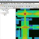
Depthmap is a single software platform to perform a set of spatial network analyses designed to understand social processes within the built environment. It works at a variety of scales from building through small urban to whole cities or states. ...

Author University College London
License Open Source
Price FREE
Released 2020-11-08
Downloads 433
Filesize 35.10 MB
Requirements
Installation Instal And Uninstall
Keywords urban environment, urban map, spatial network analysis, environment, map, analysis
Users' rating
(23 rating)
UCL DepthmapCADWindows XP, Windows Vista, Windows Vista x64, Windows 7, Windows 7 x64, Windows 8, Windows 8 x64, Windows 10, Windows 10 x64, Windows 11
UCL Depthmap map application - Download Notice

Using UCL Depthmap Free Download crack, warez, password, serial numbers, torrent, keygen, registration codes, key generators is illegal and your business could subject you to lawsuits and leave your operating systems without patches. We do not host any torrent files or links of UCL Depthmap on rapidshare.com, depositfiles.com, megaupload.com etc. All UCL Depthmap download links are direct UCL Depthmap full download from publisher site or their selected mirrors.
Avoid: map application oem software, old version, warez, serial, torrent, UCL Depthmap keygen, crack.
Consider: UCL Depthmap full version, map application full download, premium download, licensed copy.

UCL Depthmap map application - The Latest User Reviews

Most popular CAD downloads

GPS Utility

5.51 download

GPS Utility is an easy-to-use application that provides management and manipulation of GPS information. ... text formats. The program converts between different map datums and many coordinate formats (Lat/Long, UTM/UPS, country ...

5 award

GEOPoint

5.1 download

... coordinates directly, or by clicking on a world map; select earth station location from a built-in list ... satellite azimuth and elevation contours on the world map to aid in site selection; entry of latitude ...

5 award

GetNexrad

4.4.2 download

... 0.5 dBZ long range higher resolution images. Goggle Map overlays, real-time surface observations, and a web browser sidebar for even more real-time weather info. ...

QGIS

3.36.1 download

QGIS is a professional GIS application that is built on top of and proud ... database formats and lets you browse and create map data on your computer. QGIS supports many ...

Panoply for Mac

5.4.3 download

Panoply for Mac is a cross-platform application which plots geo-gridded arrays from netCDF, HDF and ... in order to generate geo-gridded plots. Since the application deploys on the Java Runtime, Panoply can be ...

CueMol

2.2.3.442 download

... format), MSMS surface data, and GRASP electrostatic potential map. ...

Mobile Atlas Creator

2.2.1 download

... offline atlases for GPS handhelds and cell phone applications like TrekBuddy, AndNav and other Android and WindowsCE based applications. For the full list of supported applications please see the features section. Additionally individual maps ...

Excellink

2015 download

EXCELLINK 2015 is an ARX application for Autodesk AutoCAD 2015 - 32/64-bit (plus a ... 2007, 2006, 2005 and 2004, incl. Architecture, Mechanical, Map, Civil). It allows to bi-directionally hot link attribute ...

Mobile Atlas Creator for Mac OS X

2.2.1 download

... offline atlases for GPS handhelds and cell phone applications like TrekBuddy, AndNav and other Android and WindowsCE based applications. For the full list of supported applications please see the features section. Additionally individual maps ...

Open Visual Trace Route

1.7.1 download

... Now you can use this accessible and easy-to-use application to view the shortest route between where you ... Traceroute Packet sniffer Whois 3D and 2D Map visualisation Export data to image or text Gantt ...