Panoweaver-professional 8.00

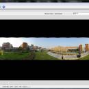
Panoweaver is the world-leading panorama stitching software, which supports stitching single /multiple rows images taken by normal lens, wide angle lens, and fisheye lens. Panoramas can be created automatically by clicking one button. Besides stitching panoramas, Panoweaver also exports 360 panoramic images into Flash VR, QuickTime VR, HTML5. Advanced features include HDR creation, camera RAW image stitching and so on. ...

Author Easypano Holdings Inc.
License Free To Try
Price $399.95
Released 2012-03-31
Downloads 246
Filesize 60.40 MB
Requirements PIII800MHz, 512M RAM, Network card, Video display of 800*600 pixels
Installation Install and Uninstall
Keywords flash panorama, spherical panorama, panorama stitching, 360 degree panorama, stitch, panorama stitching software, flash, easypano, panorama, 360 degree panorama, pano, panoramic, panoweaver, 360, fisheye lens, real estate tour, stitcher, HDR, camera raw, smart blend
Users' rating
(36 rating)
Panoweaver-professionalOtherWin2000, Windows 7 x32, Windows 7 x64, WinOther, Windows Vista, Windows Vista x64, Windows XP, Other
Our rating 5 award
Panoweaver-professional map software - Download Notice

Using Panoweaver-professional Free Download crack, warez, password, serial numbers, torrent, keygen, registration codes, key generators is illegal and your business could subject you to lawsuits and leave your operating systems without patches. We do not host any torrent files or links of Panoweaver-professional on rapidshare.com, depositfiles.com, megaupload.com etc. All Panoweaver-professional download links are direct Panoweaver-professional full download from publisher site or their selected mirrors.
Avoid: map software oem software, old version, warez, serial, torrent, Panoweaver-professional keygen, crack.
Consider: Panoweaver-professional full version, map software full download, premium download, licensed copy.

Panoweaver-professional map software - The Latest User Reviews

Most popular Other downloads

QField

3.7.9 download

... power of QGIS to the field. This innovative software is tailored for professionals who require robust, efficient, ... and users. This not only ensures that the software remains up-to-date with the latest technological advancements but ...

New Version

Helicon Focus

8.3.8 download

... Helicon Soft Ltd., is a sophisticated focus stacking software designed to meet the needs of photographers and ... Helicon Focus is its advanced rendering algorithms. The software offers multiple stacking methods—Weighted Average, Depth Map, and ...

New Version

Panoweaver-professional-for-Windows

8.20 download

Panorama software-Panoweaver is the world-leading panorama stitching software. It supports stitching single/multiple rows images taken by ... and with the following main features: 1. Google/bing map is available to users who have already had ...

5 award

Triaxes 3DMasterKit

11.1 download

3DMasterKit software is designed for creating lenticular pictures with realistic ... slidebar (stereo shooting). - Layers and Depth Map 3DMasterKit creates 3D images out of a single ... of 3D effect. 3DMasterKit also uses a depth map for each separate layer to build up a ...

ClickCharts Flowcharts Free for Mac

9.50 download

... flowcharts and diagrams easily with this free Mac software. Quickly create strong visuals of an organization, process, mind map, UML diagram and more. Map out your value streams and data flow. Find ...

ClickCharts Flowcharts Gratuito per Mac

9.08 download

... facilmente diagrammi di flusso e diagrammi con questo software per Mac gratuito. Quickly create strong visuals of an organization, process, mind map, UML diagram and more. Mappare i flussi di

ConceptDraw MINDMAP Professional Mac

5.4 download

... PowerPoint presentations. Key Features: - Synchronized Outline and Map views - Vector drawing tools - The Brainstorming ... for Windows and Macintosh - Export of mind map, outline and text notes to iPod ...

WeatherStudio

2 download

... data, products, maps, and charts into a single map that the user can pan and zoom. GFS/NDFD/NAM/RAP Model Data, Placefiles, Radar Loops, Satellite, Storm Reports, Hurricane Paths, Surface Observations, Watches/Warnings, ...

Adobe InDesign CS5

CC 2025 Build 20.4.1 download

... print and digital publishing Adobe® InDesign® CS5.5 software lets you design and preflight engaging page layouts ... What is InDesign? Adobe® InDesign® CS5.5 software lets you design and preflight engaging page layouts ...

PixGPS

1.1.8 download

... with the photo. You can later use other software with EXIF GPS support to view the exact ... or you can use whe simple 'View on map' function in PixGPS to view the location in ...