Image Constructor 2.5

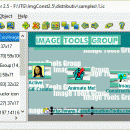
Image Constructor helps you to create original illustrations, schemas and diagrams, simple geographical maps and location plans in form of texts and small images over some background with picture or gradient fill and save them to graphical files. Key features: support of most popular image formats; use prepared or your own image collections; options for object(s) and image edition; illustration scaling; export to HTML5, BMP, JPEG, PNG or GIF. ...

Author Image Tools Group
License Free To Try
Price $25.00
Released 2017-12-20
Downloads 587
Filesize 7.19 MB
Requirements No special requirements
Installation Install and Uninstall
Keywords imageconstructor, image, constructor, presentation, picture, geographical map, plan, graphics, webgraphics, flowchart, diagram, schema, image collection, GIF, publishing, homepage, imageediting, web, business, software, downloads
Users' rating
(23 rating)
Image ConstructorEditorsWindows XP, Windows Vista, Windows 7 x32, Windows 7 x64, WinServer, Windows 10, Windows 8
Image Constructor map - Download Notice

Using Image Constructor Free Download crack, warez, password, serial numbers, torrent, keygen, registration codes, key generators is illegal and your business could subject you to lawsuits and leave your operating systems without patches. We do not host any torrent files or links of Image Constructor on rapidshare.com, depositfiles.com, megaupload.com etc. All Image Constructor download links are direct Image Constructor full download from publisher site or their selected mirrors.
Avoid: map oem software, old version, warez, serial, torrent, Image Constructor keygen, crack.
Consider: Image Constructor full version, map full download, premium download, licensed copy.

Image Constructor map - The Latest User Reviews

Most popular Editors downloads

Edraw Max

8.4 download

... work flow diagram, business form, network diagrams, mind map, business cards and database diagrams. With pre-drawn libraries ... program structures, network diagrams, chart and graphics, mind map, directional maps and database diagrams. Edraw Max includes ...

HoudahGeo

6.4.3 download

... add GPS track logs. * Use the built-in map to assign or adjust photo locations. Use reverse ... * Geocoding without a GPS. Use the built-in map to double-check, adjust, or assign locations * Reverse ...

3DField

4.6.7.0 download

"3DField" by Vladimir Galouchko is a robust and versatile software designed for the creation of 3D surface maps and contour plots from your data sets. This powerful tool caters to a ...

Pro Motion

NG download

... is a graphic editor, sprite animation and tile map design package, ideal for creating pixel precise animations, ... container - seamless tile graphic engine - tile map designer - unlimited undo/redo - tons of paint ...

Displacement Map

1.0 download

Displacement Map is an amusing image distortion, Photoshop-compatible plug-in for ... The user is free to choose any displacement map which determines the shape of the image deformation ... very useful for artistic image processing. The Displacement Map has a stylish, user-friendly, intuitive, multi-lingual interface. A ...

HDR Expose 64bit

2.1.1 build 9804 download

HDR Photography Beyond Your Imagination – HDR Expose and 32 Float Capturing a high contrast scene has always vexed photographers. We’ve all tried neutral density filters for landscapes and lighting ...

HDR Expose

2.1.1 build 9804 download

HDR Photography Beyond Your Imagination – HDR Expose and 32 Float Capturing a high contrast scene has always vexed photographers. We’ve all tried neutral density filters for landscapes and lighting ...

Ryijy Stitch Designer

1.4.0 download

... or saved to file with grid or color map. Also own color palettes from DMC colors or ... the image Printing and saving with grid, color map and symbols Contrast and saturation adjustment ...

3DFieldPro x64

4.6.5 download

... polygons, 3D view relief contour, and OpenGL 3D map with contours and textures. 3DFieldPro x64 helps you ... 3D planes, add volume boundary, load a base map over contour maps, and carry out 2D data ...

RasterStitch x64

4.0 download

... desktop A4 (21x29 cm) scanner or scan a map case of 50x50 cm by individual fragments and then join them to create the whole picture. The stitch line is created ...