Kst 2.0.8

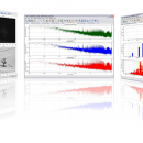
Kst is the fastest real-time large-dataset viewing and plotting tool available (you may be interested in some benchmarks) and has built-in data analysis functionality. Kst is very user-friendly (both the community and the program itself!). Kst contains many powerful built-in features and is expandable with plugins and extensions (see developer information in the "Ressources" section). ...

Author Barth Netterfield
License Open Source
Price FREE
Released 2014-07-14
Downloads 248
Filesize 10.10 MB
Requirements
Installation Instal And Uninstall
Keywords view large-datasets, dataset viewer, plot dataset, view, plotter, viewer
Users' rating
(10 rating)
KstCADWindows XP, Windows Vista, Windows Vista x64, Windows 7, Windows 7 x64, Windows 8, Windows 8 x64
Kst mapping - Download Notice

Using Kst Free Download crack, warez, password, serial numbers, torrent, keygen, registration codes, key generators is illegal and your business could subject you to lawsuits and leave your operating systems without patches. We do not host any torrent files or links of Kst on rapidshare.com, depositfiles.com, megaupload.com etc. All Kst download links are direct Kst full download from publisher site or their selected mirrors.
Avoid: mapping oem software, old version, warez, serial, torrent, Kst keygen, crack.
Consider: Kst full version, mapping full download, premium download, licensed copy.

Kst mapping - The Latest User Reviews

Most popular CAD downloads

Gwyddion

2.66 download

... visualization: false color representation with different types of mapping · shaded, logarithmical, gradient- and edge-detected, local contrast representation, Canny lines · OpenGL 3D data display: false color or material representation ...

Artlantis Studio

9.5.2.32351 download

... Real-time radiosity preview Viewpoints Inspectors Postcards Shaders Texture mapping 3D People Billboards Use reference file Main exchange file formats Heliodons Neon shaders HDRI background Projected view Insertion into the site ...

GPS Utility

5.51 download

GPS Utility is an easy-to-use application that provides management and manipulation of GPS information. You can use it to transfer data to/from a GPS receiver and store the data in PC ...

5 award

GreatCirc

4.2 download

**GreatCirc: Navigating the Skies with Precision and Ease** GreatCirc, developed by Garry Hausfeld, is a specialized software tool designed for aviation enthusiasts, pilots, and navigators who require precise calculations for ...

5 award

PotterDraw

1.0.02.000 download

... Wavefront OBJ file. PLY export supports both texture mapping and vertex color. Export 2D images as BMP or PNG files. Built-in palette editor; print and print preview; full screen mode. ...

QGIS

3.36.1 download

... to allow the use of QGIS libraries in mapping applications · Improved MapServer export tool · Vector layer transparency and antialiasing · GRASS support in all platforms · Enhanced GRASS ...

MapInfo Professional

17.0.4 download

MapInfo Professional is a full-featured computer mapping and GIS analysis utility that provides a rich ... full-featured desktop solution to prepare data for web mapping applications and create presentation quality maps in a ...

Screen Protractor Mac Edition

3.2 download

... radians. - Cartography: measure bearings and overlay any mapping software or images. - Microscopy: measure tiny biological forms. - Criminology: accurately detect angles from crime scene photos. You may download ...

TrueSpace

7.61 download

... shows the rendered character (left), and the UV mapping for his head and face in the UV Editor (right). Behavioral animations: · Objects in trueSpace can be given behaviors ...

Aqsis Renderer for Windows

1.8.2 download

... * Subdivision Surfaces (SDS) * High quality texture mapping * Level of Detal (LOD) * High Dynamic Range (HDR) Output * Extensible through plugins (DSO/Procedurals) Features: The Aqsis ...