ArcReader 10.5.0 B6491

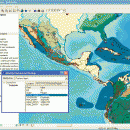
ArcReader is a free, easy-to-use desktop mapping application that allows users to view, explore, and print maps and globes. ArcReader is a free and easy-to-use application that allows users to view and print maps that are published as Published Map Files (PMF) by the ArcGIS Publisher extension to ArcView, ArcEditor, and ArcInfo. ...

Author ESRI
License Freeware
Price FREE
Released 2017-02-02
Downloads 258
Filesize 444.00 MB
Requirements
Installation Instal And Uninstall
Keywords view map, print PMF map, export bitmap, view, viewer, map, print
Users' rating
(9 rating)
ArcReaderCADWindows XP, Windows Vista, Windows Vista x64, Windows 7, Windows 7 x64, Windows 8, Windows 8 x64
ArcReader mapping tools - Download Notice

Using ArcReader Free Download crack, warez, password, serial numbers, torrent, keygen, registration codes, key generators is illegal and your business could subject you to lawsuits and leave your operating systems without patches. We do not host any torrent files or links of ArcReader on rapidshare.com, depositfiles.com, megaupload.com etc. All ArcReader download links are direct ArcReader full download from publisher site or their selected mirrors.
Avoid: mapping tools oem software, old version, warez, serial, torrent, ArcReader keygen, crack.
Consider: ArcReader full version, mapping tools full download, premium download, licensed copy.

ArcReader mapping tools - The Latest User Reviews

Most popular CAD downloads

Geneious PRO x64

6.0.4 download

... large assemblies * Restriction and Gateway® Cloning, restriction mapping, digestion and ligation * Automated primer design with ... links to material in Geneious * All the tools a budding bioinformatician may need is just a ...

GPS Utility

5.51 download

... generated in either track or route/waypoint forms. Other tools allow you to analyse and average the GPS information. Routes may be exported as Route cards. GPS Utility supports many ...

5 award

GreatCirc

4.2 download

... accessibility for users. Its compatibility with other navigation tools and data formats enhances its utility, allowing users ... or a student of geography, GreatCirc offers the tools you need to navigate the skies with confidence ...

5 award

QGIS

3.36.1 download

... Improved vector and attribute editing · Improved measure tools with area measuring · Attribute searching · New ... to allow the use of QGIS libraries in mapping applications · Improved MapServer export tool · Vector ...

MapInfo Professional

17.0.4 download

MapInfo Professional is a full-featured computer mapping and GIS analysis utility that provides a rich set of tools and advanced options for processing geography and topology ... full-featured desktop solution to prepare data for web mapping applications and create presentation quality maps in a ...

TrueSpace

7.61 download

... use them in Virtual Earth. New Modeling Tools: · The already powerful range of modeling tools in trueSpace is expanded with this release, making ... to tidy up geometry after booleans or imports; tools to optimise triangulation or quadrifying polygons to ensure ...

Aqsis Renderer for Windows

1.8.2 download

... surfaces, subpixel displacements and more. The Aqsis tools provide a comprehensive list of features that are ... * Subdivision Surfaces (SDS) * High quality texture mapping * Level of Detal (LOD) * High Dynamic ...

Geneious PRO

6.0.4 download

... large assemblies * Restriction and Gateway® Cloning, restriction mapping, digestion and ligation * Automated primer design with ... links to material in Geneious * All the tools a budding bioinformatician may need is just a ...

Geneious PRO for Vista

4.7.6 download

... large assemblies * Restriction and Gateway® Cloning, restriction mapping, digestion and ligation * Automated primer design with ... links to material in Geneious * All the tools a budding bioinformatician may need is just a ...

Aqsis Renderer for Mac OS X

1.8.2 download

... surfaces, subpixel displacements and more. The Aqsis tools provide a comprehensive list of features that are ... * Subdivision Surfaces (SDS) * High quality texture mapping * Level of Detal (LOD) * High Dynamic ...