HoudahGeo 6.4.3

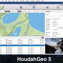
HoudahGeo is a photo geocoding and geotagging tool. Use HoudahGeo to attach GPS coordinates and location names to your photos. HoudahGeo writes EXIF and XMP geotags to JPEG and RAW image files. This creates a permanent record of where a photo was taken. Just like a GPS-enabled camera. HoudahGeo supports many methods of geocoding: Use a GPX track log, reference photos taken with iPhone, or pick locations on the built-in map. ...

Author Houdah Software s.à r.l
License Demo
Price $39.00
Released 2023-12-17
Downloads 1636
Filesize 27.38 MB
Requirements Apple macOS 10.14 Mojave through 13 Ventura. Digital camera. GPS/GPX track logger optional.
Installation No Install Support
Keywords photo, geocode, geotag, apple, mac, osx, macos, photos, lightroom, gps, gpx, nmea, exif, xmp, iptc, jpeg, raw, map, coordinates, places, location, aperture
Users' rating
(50 rating)
HoudahGeoEditorsMac OS X,
HoudahGeo maps - Download Notice

Using HoudahGeo Free Download crack, warez, password, serial numbers, torrent, keygen, registration codes, key generators is illegal and your business could subject you to lawsuits and leave your operating systems without patches. We do not host any torrent files or links of HoudahGeo on rapidshare.com, depositfiles.com, megaupload.com etc. All HoudahGeo download links are direct HoudahGeo full download from publisher site or their selected mirrors.
Avoid: maps oem software, old version, warez, serial, torrent, HoudahGeo keygen, crack.
Consider: HoudahGeo full version, maps full download, premium download, licensed copy.

HoudahGeo maps - The Latest User Reviews

Most popular Editors downloads

Edraw Max

8.4 download

... network diagrams, chart and graphics, mind map, directional maps and database diagrams. Edraw Max includes all the libraries and examples of Edraw product line. Edraw Max is an all-in-one diagram ...

HoudahGeo

6.4.3 download

... project for viewing in Google Earth, Google My Maps, or FLickr. Feature highlights: * Write GPS data, location names, title, description, and keywords to EXIF, XMP and IPTC tags * ...

Drawtify Designer Mac

1.11.10 download

... Built-in rich design plugins (including QR codes, barcodes, maps, charts) 4. With 10K+ icon graphics, 1000+ editable design elements, 200+ color schemes 5. Comes with millions of high-definition copyright-free photos ...

Displacement Map

1.0 download

... plug-in is supplied with a set of displacement maps. It is very useful for artistic image processing. The Displacement Map has a stylish, user-friendly, intuitive, multi-lingual interface. A user can ...

PhotoLine

22.01 download

... Export * Tile images, create buttons and image maps Many more * Batch conversion * Create slideshows * Record actions * Print multipage documents, flyers and labels * ...

HDR Expose

2.1.1 build 9804 download

... data in your HDR image and "dynamic range maps" it into a file that retains naturally clear highlights, vibrant mid-tones and beautifully open shadows. HDR Expose can do this ...

HDR Expose 64bit

2.1.1 build 9804 download

... data in your HDR image and "dynamic range maps" it into a file that retains naturally clear highlights, vibrant mid-tones and beautifully open shadows. HDR Expose x64 can do ...

Box Shot 3D

4.15.1 download

... Shot 3D allows to load height and specular maps and create relief-effect on the flat sides of shapes. This gives endless possibilities for book covers, cards and other objects. See ...

RoboGEO

6.3.2 download

Geotag digital images with latitude, longitude, altitude, and direction information. RoboGEO stamps this information onto the actual photo or writes it to the EXIF headers. In addition, RoboGEO allows you to ...

3DField

4.6.7.0 download

... software designed for the creation of 3D surface maps and contour plots from your data sets. This ... in its rendering capabilities, producing high-quality 3D surface maps that are both visually appealing and highly informative. ...