Vextractor 7.20

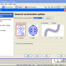
Vextractor is a vectorizer program for transforming raster images to vector formats by building centerlines and outlines. This tool could be used for the vectorizing photo, logotypes and other line art images for use in Vector Graphics Design software. You can also vectorize charts, drawings, maps and schemes for input to CAD or GIS systems. Supported vector formats: DXF, WMF, EMF, SVG, EPS, AI, Shape, MapInfo, ASCII XYZ. ...

Author VextraSoft
License Free To Try
Price $99.95
Released 2018-08-25
Downloads 2057
Filesize 12.34 MB
Requirements Pentium III, 128 Mb RAM
Installation Install and Uninstall
Keywords raster to vector, image to vector, raster, vector, vectorise, vectorize, vectorization, vectorizing, trace, convert, conversion, r2v, scan, cad, autocad, dxf, tiff, gif, bmp.jpg, jpeg, polyline, centerline, outline, image, gis, digitize, digitizing
Users' rating
(40 rating)
VextractorEditorsWindows XP, Windows Vista, Windows 7 x32, Windows 7 x64, Windows 2000, Windows 2003, Windows Vista, Windows Vista
Vextractor scan - Download Notice

Using Vextractor Free Download crack, warez, password, serial numbers, torrent, keygen, registration codes, key generators is illegal and your business could subject you to lawsuits and leave your operating systems without patches. We do not host any torrent files or links of Vextractor on rapidshare.com, depositfiles.com, megaupload.com etc. All Vextractor download links are direct Vextractor full download from publisher site or their selected mirrors.
Avoid: scan oem software, old version, warez, serial, torrent, Vextractor keygen, crack.
Consider: Vextractor full version, scan full download, premium download, licensed copy.

Vextractor scan - The Latest User Reviews

Most popular Editors downloads

PageFocus Draw

10.35 download

... business/ID cards, video snapshots, forms and graphic patterns. Scan and edit a document. Turn photo into drawings or paintings. Open, edit and create PDFs. Design and build web pages. Create ...

Vextractor

7.20 download

... palette transformation for raster to vector conversion; TWAIN32-compatible scanner support; Coordinate referencing for CAD and GIS; Input Z-values (elevation) for GIS. ...

RasterStitch x64

4.0 download

... to create a panorama of several photographs or scan and join fragments of a paper document, which dimensions exceed the scanner workspace. For example, you can scan a draft of the A0 format with a ...

RasterVect

27.5 download

... purpose of RasterVect is to quickly convert uneditable scanned paper drawings into accurate vector files for editing ... vector converter: 1. Create a raster file by scanning the paper drawing into RasterVect using a scanner. ...

PDFill PDF Editor

15.0 Build 2 download

... draw your signature into PDF. - PDF Scanner Scan your Paper Form or Photo directly into a ...

5 award

Adobe Photoshop Elements

2024.3 download

... your computer according to your preset preferences. Or scan several photos at once, and Adobe® Photoshop® Elements automatically divides, straightens, and saves each photo separately. Find what you need ...

Ultra Fractal Standard Edition

6.06 download

... files with the integrated Explorer-like file browsers. Quickly scan formula files and parameters with the new thumbnail view and the powerful search tools. Render your artwork to produce fractal ...

IdPhotos Pro

8.16.4.1 download

ID Photos Pro, developed by PIXEL-TECH, is a sophisticated yet user-friendly software tailored for creating professional-quality ID photos. This application stands out for its precision, efficiency, and compliance with international standards, ...

Boxoft Duplicate Image Finder

1.6 download

... to use, you just select the folder to scan and begin the search. Using its innovative content-based ... image similarity that will be used during the scan. Using the similarity percentage level you can broaden ...

Vextractor x64

7.20 download

... palette transformation for raster to vector conversion; TWAIN32-compatible scanner support; Coordinate referencing for CAD and GIS; Input Z-values (elevation) for GIS. ...