NTv2Creator 6.14

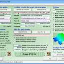
... modeling accurate NTv2 files from identical points in two different Reference Systems. The software analyses two files with identical points and suggests the boundaries and mesh sizes which can then be changed manually. ...

Author Killet GeoSoftware Ing.-GbR
License Free To Try
Price $535.00
Released 2025-05-26
Downloads 377
Filesize 8.42 MB
Requirements Pentium, 30 MB HD
Installation Install and Uninstall
Keywords modelling, modeling, creation, create, generate, calculate, ntv2 file, ntv2, gsa, gsb, createing ntv2 file, modeling ntv2 file, geodetic, datum shift, datum, shift, ntv2creator, killetsoft
Users' rating
(22 rating)
NTv2CreatorGeographyWin2000, Windows XP, Windows 7 x32, Windows 7 x64, Windows 8, Windows 10, WinServer, WinOther, Windows 2000, Windows 2003, Windows Server 2000, Windows Server 2003, Windows Server 2008, Windows Server 2008r2, Windows Server 2012, Windows Tablet PC Edition 2005, Windows Media Center Editi
NTv2Creator two or more - Download Notice

Using NTv2Creator Free Download crack, warez, password, serial numbers, torrent, keygen, registration codes, key generators is illegal and your business could subject you to lawsuits and leave your operating systems without patches. We do not host any torrent files or links of NTv2Creator on rapidshare.com, depositfiles.com, megaupload.com etc. All NTv2Creator download links are direct NTv2Creator full download from publisher site or their selected mirrors.
Avoid: two or more oem software, old version, warez, serial, torrent, NTv2Creator keygen, crack.
Consider: NTv2Creator full version, two or more full download, premium download, licensed copy.

NTv2Creator two or more - The Latest User Reviews

Most popular Geography downloads

NTv2Creator

6.14 download

... modeling accurate NTv2 files from identical points in two different Reference Systems. The software analyzes two files with identical points and suggests the boundaries ...

UTM Coordinate Converter

2.0.4 download

... location you would like converted (see Features for more details). The converter supports converting between locations in Decimal Degrees, Degree Minutes, Degree Minutes Seconds and UTM. The following UTM Datums ...

21st century worldwide growth of Forest

8.24 download

... how fast will Forest grow if we got more? - This simulation will allow you to check ... can do it better, each of them no more complex than the simple Rule of Three. You ...

Grass GIS for Linux

8.2.0 download

... Programming Interface (API) make the new module development more efficient and allow to integrate new functionality into GRASS. Applications can be also written with shell scripts to automate the GIS ...

Google Earth for Android

10.41.0.7 download

... experiences from Sesame Street, BBC Earth, NASA and more. People will be able to visit any place on Earth, in a 3D setting, they will be able to “walk” the ...

Google Earth for iOS

10.42.1 download

... experiences from Sesame Street, BBC Earth, NASA and more. People will be able to visit any place on Earth, in a 3D setting, they will be able to “walk” the ...

Enigeo

4.2.0 download

... and learn about different countries. Features: Two modes: quiz mode and explorer mode Highly customizable quiz You can choose between different types of questions Possible limitation to continents ...

Find Distance Between Multiple World Cities Software

7.0 download

... want to find the distance between one or more cities in the world. You can add cities individually or load a set from a text file. The application displays the ...

UTM Coordinate Converter Mac Silicon

2.0.4 download

... location you would like converted (see Features for more details). The converter supports converting between locations in Decimal Degrees, Degree Minutes, Degree Minutes Seconds and UTM. The following UTM Datums ...

GPS TrackMaker

13.9.596 download

... tracklogs, routes, and insert scanned images of map. More than 160 GPS models recognized. Garmin, Magellan, Eagle ... maps Download and upload Waypoints, Tracklogs and Routes More than 260 waypoint icons Calibrate map images in ...