Thuban for Windows 1.2.2

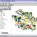
Thuban is an Interactive Geographic Data Viewer with the following features:

# Vector Data Support: Shapefile, PostGIS Layer and OGR
# Raster Data Support: GeoTIFF Layer and GDAL
# Comfortable Map Navigation
# Object Identification and Annotation
# Legend Editor and Classification
# Table Queries and Joins
# Projection Support
# Printing and Vector Export
# API for Add-Ons (Extensions) ...

Author Thuban Development Team
License Open Source
Price FREE
Released 2009-08-18
Downloads 202
Filesize 11.22 MB
Requirements
Installation Instal And Uninstall
Keywords geographic data viewer, gis viewer, analyze geographic information, information, geographic, viewer
Users' rating
(19 rating)
Thuban for WindowsCADWindows 2000, Windows 2003, Windows XP, Windows Vista
Thuban for Windows values and data - Download Notice

Using Thuban for Windows Free Download crack, warez, password, serial numbers, torrent, keygen, registration codes, key generators is illegal and your business could subject you to lawsuits and leave your operating systems without patches. We do not host any torrent files or links of Thuban for Windows on rapidshare.com, depositfiles.com, megaupload.com etc. All Thuban for Windows download links are direct Thuban for Windows full download from publisher site or their selected mirrors.
Avoid: values and data oem software, old version, warez, serial, torrent, Thuban for Windows keygen, crack.
Consider: Thuban for Windows full version, values and data full download, premium download, licensed copy.

Thuban for Windows values and data - The Latest User Reviews

Most popular CAD downloads

NetLogo

6.0.4 download

... used by tens of thousands of students, teachers and researchers worldwide. It also powers HubNet participatory simulations. It is authored by Uri Wilensky and developed at the CCL. You can download it ...

MITCalc Tolerance analysis

1.19 download

... programs for the tolerance analysis of linear, 2D and 3D dimensional chains 1) Tolerance analysis of linear ... solves the following problems: - Tolerance analysis, synthesis and optimization of a dimensional chain using the arithmetic ...

UN-SCAN-IT

7.0 download

... Software converts graph image files to usable (x,y) data automatically. UN?SCAN?IT works with most image formats (TIFF, ... digital camera, or other image source to digitize data from strip charts, instrumental output, old graphs, published ...

CityCAD

2.8.2 download

... specifically for the needs of the city design and planning community and enables integrated, holistic analysis of your urban masterplans ... are: improves productivity on city design, planning and development projects. maintains and enhances design quality makes ...

Thuban for Windows

1.2.2 download

Thuban is an interactive geographic data viewer (GIS viewer) which features methods to visualize, explore, and analyze geographic information. Thuban is an Interactive Geographic Data Viewer with the following features: # Vector ...

AcaStat for Mac OS X

10.1.11 download

AcaStat is an inexpensive and easy-to-use data analysis tool. Create and analyze crosstabulations, descriptive statistics, basic significance tests, and summary reports. Ideal for those who need a ... at school or work. AcaStat includes three data analysis modules (Data Grid, SumStats, Decision Tools) and ...

FOIL Release

4.5 download

Vacanti Yacht Design LLC FOIL Design and Analysis program provides a Windows CAD user interface and CAD file export for the well known Eppler ... than 10 million) operation on Virtually all Sail and Power design applications. If a new keel ...

RISAConnection

13.0.0 download

... giving you full control of the connection type and components and the speed to change the connection with a ... out of calculations by listing explicitly the calculations and the code check values. Review your results in ...

ShapeBook with 2D3DSteel

4.4.2009 download

... a quick reference tool for the detailing dimensions and design properties of steel shapes. ShapeBook is also ... creates steel material lists with weight, surface area, and price extensions. ShapeBook also includes a shape search ...

5 award

GeoMapApp

3.7.1 download

GeoMapApp is a map-based application for browsing, visualizing and analyzing a diverse suite of curated global and regional geoscience data sets. These cover geophysics, geology, geochemistry, physical oceanography, climatology, and more. GeoMapApp provides data layering, display customization ...