Elshayal Smart 23.02

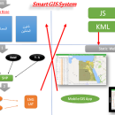
... Earth, and Trace & save GPS route and View and Rectify Raster Images gif, jpg, bmp and ... remove layers, swap layers, save layer, set layer data source, layer properties, zoom in & zoom out, pan, identify, selecting features, invert selection, show data table, data query builder, location query builder, build network. ...

Author Elshayal Smart Web On Line Software
License Freeware
Price FREE
Released 2023-02-28
Downloads 209
Filesize 6.00 MB
Requirements
Installation Instal And Uninstall
Keywords edit map, GIS editor, edit GIS, GIS, editor, raster
Users' rating
(27 rating)
Elshayal SmartCADWindows Vista, Windows Vista x64, Windows 7, Windows 7 x64, Windows 8, Windows 8 x64, Windows 10, Windows 10 x64
Elshayal Smart view data - Download Notice

Using Elshayal Smart Free Download crack, warez, password, serial numbers, torrent, keygen, registration codes, key generators is illegal and your business could subject you to lawsuits and leave your operating systems without patches. We do not host any torrent files or links of Elshayal Smart on rapidshare.com, depositfiles.com, megaupload.com etc. All Elshayal Smart download links are direct Elshayal Smart full download from publisher site or their selected mirrors.
Avoid: view data oem software, old version, warez, serial, torrent, Elshayal Smart keygen, crack.
Consider: Elshayal Smart full version, view data full download, premium download, licensed copy.

Elshayal Smart view data - The Latest User Reviews

Most popular CAD downloads

OpenRocket

14.06 download

... Easy-to-use user interface for rocket design Real-time view of CG and CP position Real-time flight altitude, ... continuous simulation performed in the background Zoomable schematic view of rocket from the side or rear, with ...

DataNumen DWG Recovery

4.0 download

DataNumen DWG Recovery is a powerful tool to repair ... can scan the DWG files, then recover your data in them as much as possible, so to ... STYLE CONTROL OBJ, STYLE, LTYPE CONTROL OBJ, LTYPE, VIEW CONTROL OBJ , VIEW, UCS CONTROL OBJ, UCS, ...

2D/3D cad: dwg, dxf, plt, cgm, svg, pdf

14 download

... SVG, CGM, PLT, HPGL and other file formats. Viewing. ABViewer enables to view 2D and 3D files, measure them and convert ... formats. It is possible to create a section view of a 3D model, see its hidden elements ...

MITCalc Timing Belts Calculation

1.21 download

... - Selection of an optimum transmission alternative in view of power, geometry and weight. - Option of ... and belts. The calculations use procedures, algorithms and data from ANSI, RMA (Rubber Manufacturers Association), ISO, DIN, ...

MagicPlot Pro for Linux

2.9.3 download

... is a handy tool for scientific and engineer data processing, plotting and nonlinear fitting. MagicPlot Pro is ... you! Nonlinear Curve Fitting Enter equation, edit data range visually and perform a fit. MagicPlot was ...

PlotVision

8.02.1216 download

... line types, fonts etc. This means that data and information created in any CAD program can be exchanged, printed, controlled, integrated into production descriptions and marked up with redlines ...

Archicad 64bit

27 B3001 download

... the information about the building in a central database; changes made in one view are updated in all others, including floor plans, ... can design and edit the model in 3D view, navigate in real time to check the design, ...

GedScape

3.0.01 download

... software utility for browsing, manipulating, converting and extracting data from GEDCOM files. It is the ideal GEDCOM viewer and converter, an essential tool for genealogists. Features: Easily browse all data for individuals and families within GEDCOM files, including ...

Integrated Genome Browser

7.0.4 B15225 download

... you can use to visualize and explore genome-scale data sets, such as tiling array data, next-generation sequencing results, genome annotations, microarray designs, and ...

GEOPoint

5.1 download

... an easy to use dialog-style user interface for data entry and calculation; entry of earth station location ... and elevation contours to a KML file for viewing in Google Earth. estimation of site altitude from ...

5 award