TNTmips for Mac OS X 20240111

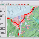
TNTmips is a geospatial image processing tool that allows you to analyze and modify GIS images. It is a professional application that can handle desktop cartography, electronic atlas preparation and spatial database management. ...

Author MicroImages, Inc.
License Freeware
Price FREE
Released 2024-01-11
Downloads 240
Filesize 87.90 MB
Requirements Mac (OS 10.8 to 11), XQuartz 2.7.9 needed (2.7.11 with manual modification)
Installation Instal And Uninstall
Keywords GIS data analysis, analyze geodetic data, edit GIS dataset, GIS, dataset, editor, analysis, mac os, TNTmips for mac, TNTgis for mac, TNTedit
Users' rating
(45 rating)
TNTmips for Mac OS XCADMac OS X
TNTmips for Mac OS X view dxf - Download Notice

Using TNTmips for Mac OS X Free Download crack, warez, password, serial numbers, torrent, keygen, registration codes, key generators is illegal and your business could subject you to lawsuits and leave your operating systems without patches. We do not host any torrent files or links of TNTmips for Mac OS X on rapidshare.com, depositfiles.com, megaupload.com etc. All TNTmips for Mac OS X download links are direct TNTmips for Mac OS X full download from publisher site or their selected mirrors.
Avoid: view dxf oem software, old version, warez, serial, torrent, TNTmips for Mac OS X keygen, crack.
Consider: TNTmips for Mac OS X full version, view dxf full download, premium download, licensed copy.

TNTmips for Mac OS X view dxf - The Latest User Reviews

Most popular CAD downloads

TNTatlas for Mac OS X

2024 B20240508 download

TNTatlas is a powerful free geodata viewer that lets you publish and distribute your maps ... file formats including shapefiles, GeoTIFF, JP2, PNG, MrSID, DXF, and DWG. Geospatial information plays a growing ...

Mini CAD Viewer

3.7.0.0 download

Mini CAD Viewer is a compact free CAD viewer.It is designed to be easy to use, even ... allows you to move and zoom in/out drawing view at will. It carries "thumbnail" view, which allows ...

TNTatlas

2024 B20240606 download

TNTatlas is a powerful free geodata viewer that lets you publish and distribute your maps ... file formats including shapefiles, GeoTIFF, JP2, PNG, MrSID, DXF, and DWG. Geospatial information plays a growing ...

VariCAD Viewer for Linux

2024 2.01 download

VariCAD Viewer is a free viewer, convertor and printing software working with 2D DWG, DXF, 3D STEP and 2D/3D VariCAD file formats. VariCAD viewer allows you to convert DWG to DXF and ...

VideoCAD Professional

14.0 download

... and car plate reading zones. While calculating camera view areas the shadows from obstacles on the scene can be taken into account. Visualize by colors and hatch spatial resolution (pixel ...

Home Plan Pro

5.8.2.1.5 download

... --Zoom In or Out --Export to bitmap or DXF ...

Tracfoil

4.12.07 download

... colors and style. Export the Airfoil on a DXF file. Save and open the different airfoil components ... you run for the first time go the View menu, select Template defaults, in the frame Units, ...

VideoCAD Starter II Kit

7.1 download

... projections of site layout with camera images, calculated view areas, and with coordinate grid to be used in graphical path of the project. Export the obtained drawing into any of ...

TNTmips for Mac OS X

20240111 download

... It provides all the tools you need to view, create, edit, georeference, interpret, and publish any type ... ECW, shapefile, File Geodatabase, Oracle Spatial, DGN, TAB, DXF, DWG. Full-featured GIS that integrates imagery along ...

MITCalc Timing Belts Calculation

1.21 download

... - Selection of an optimum transmission alternative in view of power, geometry and weight. - Option of designing a non-standard transmission. - Calculation of all necessary strength and geometrical parameters. ...