DwgGrid 2.2.3.50

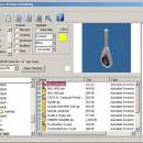
DwgGrid, DwgGrid - CAD Thumbnail Viewer and Printer. Print and save AutoCAD, Inventor, Revit, ... CAD type files. DwgGrid prints the drawing thumbnail image, file listings and the directory tree structure. DwgGrid ... contact sheets and Web pages of the thumbnail images for publishing to the Internet or your Intranet. Evaluation period includes a watermark. ...

Author Engineered Design Solutions
License Free To Try
Price $29.95
Released 2009-12-03
Downloads 1073
Filesize 1.17 MB
Requirements
Installation Install and Uninstall
Keywords acad, acadlt, autocad, cad, drawing, dwg, dwt, dwf, inventor, apprentice, iam, ide, idw, ipn, revit, rvt, rte, solidworks, sldasm, slddrw, sldprt, microstation, dgn, pro-e, asm, drw, thumbnail, jpg, preview, viewer, print
Users' rating
(12 rating)
DwgGridCADWindows XP
DwgGrid view image - Download Notice

Using DwgGrid Free Download crack, warez, password, serial numbers, torrent, keygen, registration codes, key generators is illegal and your business could subject you to lawsuits and leave your operating systems without patches. We do not host any torrent files or links of DwgGrid on rapidshare.com, depositfiles.com, megaupload.com etc. All DwgGrid download links are direct DwgGrid full download from publisher site or their selected mirrors.
Avoid: view image oem software, old version, warez, serial, torrent, DwgGrid keygen, crack.
Consider: DwgGrid full version, view image full download, premium download, licensed copy.

DwgGrid view image - The Latest User Reviews

Most popular CAD downloads

MarvinSketch

23.16.0 download

... Chemical structure drawing Molecular modeling Tune, combine and view Predictors and enumerators Structure and valence checker Working with abbreviated groups Image generation, display and formatting ...

Balony October for Mac OS X

1.4.5 download

... use application, specially designed to offer you an image analysis and data inspection for agar plates generated in high-throughput yeast genetics and genomics experiments. Basically all that you have to ...

TopoLT

15.2 download

... and contours, fill and cut volumes calculation, raster image georeferencing and automatic printing. TopoLT is running on ... movies can be saved with moving three-dimensional objects, images can be saved, 3ds files can be visualized, ...

Artlantis Studio

9.5.2.32351 download

... fact that it allows you to create panoramic images, but also animations. An interesting feature you can ... creating unique designs. FEATURES Real-time radiosity preview Viewpoints Inspectors Postcards Shaders Texture mapping 3D People Billboards ...

GEOPoint

5.1 download

... site selection; ability to save the current map image to file. ability to save azimuth and elevation contours to a KML file for viewing in Google Earth. estimation of site altitude from ...

5 award

uMark Professional

6.4 download

... on your photos. Stamp your authority over your images. Watermark hundreds of photos in one go. Add ... the watermark at your desired location on the image by specifying top, left coordinates or by drag ...

Gerbview x64

10.21 download

An advanced, but easy to use Gerber viewer. View, markup, print and convert your Gerber, Excellon and ... easy to use application that enables you to view, print, convert and markup Gerber, HPGL, HPGL/2, Excellon ...

TNTmips

20240404 download

... with virtually any type of geospatial data including imagery, terrain surfaces, and map data with associated database ... It provides all the tools you need to view, create, edit, georeference, interpret, and publish any type ...

CADbro

2020 download

CADbro is a 3D CAD viewer that helps with your collaboration on engineering data. ... management, production planning, manufacturing, technical documentation. Open and view file created by NX, Catia, Creo ProE and ...

Elshayal Smart

23.02 download

... Earth, and Trace & save GPS route and View and Rectify Raster Images gif, jpg, bmp and Edit shape files, build ... network, find shortest path, print map, save map image, copy map image to clipboard, save project map, ...