Panoply for Mac 5.4.3

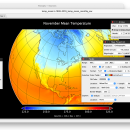
Panoply for Mac is an utility that enable user to plot raster image. Depending on the data, it can draw global longitude-latitude images or pole-to-pole latitude-vertical images.Panoply is a cross-platform application which plots geo-gridded arrays from netCDF, HDF and GRIB datasets. The utility can also combine two arrays and can project the analysis using more than 100 maps. ...

Author Robert B. Schmunk
License Freeware
Price FREE
Released 2024-06-24
Downloads 263
Filesize 36.40 MB
Requirements
Installation Instal And Uninstall
Keywords plot raster image, longitude image, pole-to-pole image, raster image, rasterize, raster
Users' rating
(24 rating)
Panoply for MacCADMac OS X
Panoply for Mac view mac - Download Notice

Using Panoply for Mac Free Download crack, warez, password, serial numbers, torrent, keygen, registration codes, key generators is illegal and your business could subject you to lawsuits and leave your operating systems without patches. We do not host any torrent files or links of Panoply for Mac on rapidshare.com, depositfiles.com, megaupload.com etc. All Panoply for Mac download links are direct Panoply for Mac full download from publisher site or their selected mirrors.
Avoid: view mac oem software, old version, warez, serial, torrent, Panoply for Mac keygen, crack.
Consider: Panoply for Mac full version, view mac full download, premium download, licensed copy.

Panoply for Mac view mac - The Latest User Reviews

Most popular CAD downloads

TNTatlas for Mac OS X

2024 B20240508 download

TNTatlas is a powerful free geodata viewer that lets you publish and distribute your maps ... nearby pages or turned to the index. To view related demographic, climatologic, or economic statistics, you looked ...

CrystalMaker for Mac OS X

11.1.0 download

... structures in real time, with the mouse. Multiple View "bookmarks" and undo levels encourage exploration and discovery - ideal for teaching and research. With CrystalMaker you can build any ...

Panoply for Mac

5.4.3 download

Panoply for Mac is a cross-platform application which plots geo-gridded arrays ... GRIB datasets. Panoply is designed to help you view and process the data included in netCDF, HDF, GRIB, and ...

Thuban for Mac OS X

1.0.1-3 download

Thuban is an interactive geographic data viewer (GIS viewer) which features methods to visualize, explore, and analyze ... information. Thuban is an Interactive Geographic Data Viewer with the following features: # Vector Data ...

SketchEl

1.60 download

... mouse gestures, keyboard shortcuts, utility commands and several view modes are offered in order to make this ... The newer datasheet feature of SketchEl allows viewing and editing of simple tables of data, for ...

Live Interior 3D Standard

2.9.1 Build 584 download

... or office of your dreams right on your Mac. Whether you are redesigning your home and making important decisions about materials and furniture or a professional designer looking to prepare ...

McCad Gerber Viewer for Mac OS X

3.1.07 download

McCad Gerber Viewer is a handy application that allows you to open Gerber files and to convert them to other formats. The program can be used to open multiple Gerber ...

Caedium Professional for Mac

5.1.3 download

Caedium Professional for Mac combines the entire Caedium add-on collection for a complete, affordable and easy-to-use Computational Fluid Dynamics (CFD) software system. Caedium Professional is an add-on to Caedium, ...

MagicPlot Viewer for Mac OS X

2.0 download

Plotvisor is a tool for viewing plots and thumbnails from multiple text/ASCII files. ... appearance is similar to that of popular image viewers: there is the directory tree, thumbnails and preview ...

TNTmips for Mac OS X

20240111 download

TNTmips for Mac is a complete Geographic Information System (GIS) that ... It provides all the tools you need to view, create, edit, georeference, interpret, and publish any type of geospatial ...