Panoply for Mac 5.4.3

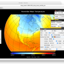
Panoply for Mac is an utility that enable user to plot raster image. Depending on the data, it can draw global longitude-latitude images or pole-to-pole latitude-vertical images.Panoply is a cross-platform application which plots geo-gridded arrays from netCDF, HDF and GRIB datasets. The utility can also combine two arrays and can project the analysis using more than 100 maps. ...

Author Robert B. Schmunk
License Freeware
Price FREE
Released 2024-06-24
Downloads 249
Filesize 36.40 MB
Requirements
Installation Instal And Uninstall
Keywords plot raster image, longitude image, pole-to-pole image, raster image, rasterize, raster
Users' rating
(24 rating)
Panoply for MacCADMac OS X
Panoply for Mac viewer for mac - Download Notice

Using Panoply for Mac Free Download crack, warez, password, serial numbers, torrent, keygen, registration codes, key generators is illegal and your business could subject you to lawsuits and leave your operating systems without patches. We do not host any torrent files or links of Panoply for Mac on rapidshare.com, depositfiles.com, megaupload.com etc. All Panoply for Mac download links are direct Panoply for Mac full download from publisher site or their selected mirrors.
Avoid: viewer for mac oem software, old version, warez, serial, torrent, Panoply for Mac keygen, crack.
Consider: Panoply for Mac full version, viewer for mac full download, premium download, licensed copy.

Panoply for Mac viewer for mac - The Latest User Reviews

Most popular CAD downloads

ANTz for Mac

2018-07-25-0251 download

ANTz for Mac was developed as an interactive and real-time 3D data viewing instrument for the cognizance of complex systems. Think of ... meets cyberspace.' An immersive multi-dimensional spatially based environment for realtime analysis and decision making. Capable of ...

QGIS for Mac

3.36.1 download

... initial goal was to provide a GIS data viewer. QGIS has reached that point in its evolution and is being used by many for their daily GIS data viewing needs. QGIS supports ...

TNTatlas for Mac OS X

2024 B20240508 download

TNTatlas is a powerful free geodata viewer that lets you publish and distribute your maps ... an easily used form. You may be responsible for the distribution of sensitive corporate or military materials ...

Panoply for Mac

5.4.3 download

Panoply for Mac is a cross-platform application which plots geo-gridded arrays ... map plots. Use any of numerous color tables for the scale colorbar, or apply your own custom ...

Voyager for Mac OS X

4.5.7 download

View the heavens on your computer from any place on Earth, in the Solar System, or beyond. Witness celestial events thousands of years in the past or future. Voyager includes millions ...

MedINRIA for Mac OS X

3.2.0 download

... lot of features concerning medical image analysis, especially for DTI analysis and fiber tracking, but also some extra tools for tensor visualization and fMRI studies. A simple image viewer is provided with the possibility to import directly ...

MeV for Mac OS X

4.8.1 download

MeV or Multiple Experiment Viewer is a Java tool to help you with ... input formats, and provides an intuitive graphical interface for clustering, classification, statistical analysis and theme discovery.

Sailcut CAD for Mac OS X

1.3.5 download

... a number of languages. It also includes a viewer where you can assembled a hull, a rig ... they match. Sailcut CAD has been successfully used for making sails for racing and cruising yacht as ...

Kst for Mac OS X

2.0.7 download

... spectra. · Color mapping and contour mapping capabilities for three-dimensional data, as well as matrix and image ... interface. · Powerful graphical user interface. · Support for several popular data formats. · Multiple tabs. · ...

Thuban for Mac OS X

1.0.1-3 download

Thuban is an interactive geographic data viewer (GIS viewer) which features methods to visualize, explore, and analyze ... information. Thuban is an Interactive Geographic Data Viewer with the following features: # Vector Data ...