Thuban for Windows 1.2.2

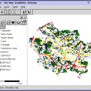
Thuban is an Interactive Geographic Data Viewer with the following features:

# Vector Data Support: Shapefile, PostGIS Layer and OGR
# Raster Data Support: GeoTIFF Layer and GDAL
# Comfortable Map Navigation
# Object Identification and Annotation
# Legend Editor and Classification
# Table Queries and Joins
# Projection Support
# Printing and Vector Export
# ...

Author Thuban Development Team
License Open Source
Price FREE
Released 2009-08-18
Downloads 203
Filesize 11.22 MB
Requirements
Installation Instal And Uninstall
Keywords geographic data viewer, gis viewer, analyze geographic information, information, geographic, viewer
Users' rating
(20 rating)
Thuban for WindowsCADWindows 2000, Windows 2003, Windows XP, Windows Vista
Thuban for Windows visualize data - Download Notice

Using Thuban for Windows Free Download crack, warez, password, serial numbers, torrent, keygen, registration codes, key generators is illegal and your business could subject you to lawsuits and leave your operating systems without patches. We do not host any torrent files or links of Thuban for Windows on rapidshare.com, depositfiles.com, megaupload.com etc. All Thuban for Windows download links are direct Thuban for Windows full download from publisher site or their selected mirrors.
Avoid: visualize data oem software, old version, warez, serial, torrent, Thuban for Windows keygen, crack.
Consider: Thuban for Windows full version, visualize data full download, premium download, licensed copy.

Thuban for Windows visualize data - The Latest User Reviews

Most popular CAD downloads

Geneious Basic x64

6.0.4 download

... for the retrieval, organization and analysis of biomolecular data that allows any molecular biologist do core bioinformatics tasks in a flash by removing painful data-administration. Geneious comes pre-bundled with bioinformatics functions from ...

Cytoscape

3.9.0 download

... with annotations, gene expression profiles and other state data. Although Cytoscape was originally designed for biological research, ... distribution provides a basic set of features for data integration and visualization. Additional features are available as ...

Amira

2019.2 download

... visualizing, manipulating, and understanding Life Science and bio-medical data coming from all types of sources and modalities. ... needs to work with clinical or preclinical image data, nuclear data, optical or electron microscopy imagery, molecular ...

pCon.planner

8.9.0.100 download

... and professionally create complex furnishing concepts and to visualize them in a photo-realistic quality. The pCon.planner ... models. The pCon.planner allows you to comfortably exchange data with the current CAD systems. Open CAD data ...

Gnuplot for Windows

5.2.7 download

... originally created to allow scientists and students to visualize mathematical functions and data interactively, but has grown to support many non-interactive ...

RADlab

1.03 download

... [1] for these detectors one needs the cross-section data to sample gamma and neutron interactions. So the cross-section data from XCOM [2] is used for gamma interacting materials, and data from ENDF [3] is used for neutron interacting ...

GProX

1.1.16 download

The Graphical Proteomics Data Explorer (GProX) is a freely available complete software ... and integrated analysis and visualization of large proteomics datasets. The program provides a range of functions for data analysis. User-friendly program layout: · Spreadsheet ...

TNTatlas

2024 B20240606 download

... you publish and distribute your maps and geospatial data — from a single geodata file to complex ... rapidly assemble and distribute existing electronic map and database materials for those working in natural disaster relief, ...

3D FastView

1.0 download

... features and functions to assemble, markup, translate and visualize large 3D CAD files and is, therefore, less ... Whats new? * compress With the world-leading 3D data compression technology, 3D FastView has the ability to ...

TNTatlas for Mac OS X

2024 B20240508 download

... you publish and distribute your maps and geospatial data — from a single geodata file to complex ... rapidly assemble and distribute existing electronic map and database materials for those working in natural disaster relief, ...