- Software
- - Graphic Apps
- - CAD
- - JMARS
JMARS 3.1.5
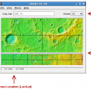
JMARS is an acronym that stands for Java Mission-planning and Analysis for Remote Sensing. It is a geospatial information system (GIS) developed by ASU's Mars Space Flight Facility to provide mission planning and data-analysis tools to NASA's orbiters, instrument team members, students of all ages, and the general public.
JMARS provides free and efficient access to more than a terabyte of NASA orbiter data, and has basic image and vector processing features to conveniently compare, plot, and blend data.
While JMARS began with a focus on Mars, it has branched out to work with data for Earth and the Moon, for which separate versions now exist. In all its variants, it's free to use and open-sourced, and is actively supported on Mac, Windows, Linux, and Solaris.
MARS can do a great many things; here are a few of them:
* Take multiple datasets (thermal inertia, mineral composition, digital elevations, etc.) and overlay them into a single, registered multilayer image.
* Make topographic profiles, extract surface temperatures (day or night), plot footprints and render remote sensing images from orbiters.
* Correlate mineral compositions with topographic data.
* Combine surface roughness data with thermal inertia data.
* Contour maps may be created.
* Groups of layers can be composed by transparency blending or building an HSV/RGB composite.
* Plots may be created by drawing multi-segment lines on the map, making it easy to sample elevation, thermal inertia, or other surface properties in an area of interest.
* Load and process raw numeric rasters, which may be stretched and colorized on the fly.
* Load and process vector data in several common formats.
* Edit vector data on the map or in a table.
* Use vector processing tools to calculate properties like line bearing or polygonal area.
* An SQL-like scripting language provides a powerful transformation and filtering feature.
And so on.
JMARS provides access to many Mars data products: image footprints and rasters from the THEMIS, MOC, CTX, HiRISE, CRISM, Viking Imaging System, HRSC, and OMEGA instruments; mosaics from THEMIS, Viking, and CTX; topography from MOLA; compositional maps from TES and GRS/HEND; albedo and thermal inertia from TES and Viking.
For the Moon, datasets include Clementine UV/VIS multispectral imaging, Lunar Orbiter imaging, Arecibo radar, and laser altimetry topography from Kaguya (Selene) and Lunar Reconnaissance Orbiter.
For Earth (in beta-development), datasets include topography and ASTER and MODIS multispectral imaging.
With all versions of JMARS (Earth, Moon, and Mars), new and improved datasets are being added continually, as quickly as instrument teams release them and the Planetary Data System makes them available.
Finally, if you are a science team member for Mars Odyssey, Mars Reconnaissance Orbiter, or Lunar Reconnaissance Orbiter, you can also use JMARS to plan observations, identify regions of interest, review previously acquired data, and examine datasets from past missions.
For more information, see the abstract from the JMARS presentation at the 2009 Fall Meeting of the American Geophysical Union.
The following provides links to some of the instruments and missions whose data is available through JMARS
| Author | Arizona State University |
| License | Freeware |
| Price | FREE |
| Released | 2014-08-12 |
| Downloads | 333 |
| Filesize | 50.00 MB |
| Requirements | |
| Installation | Instal And Uninstall |
| Keywords | mission analysis, geospatial information, GIS analysis, mission, analysis, GIS |
| Users' rating (21 rating) |
Using JMARS Free Download crack, warez, password, serial numbers, torrent, keygen, registration codes,
key generators is illegal and your business could subject you to lawsuits and leave your operating systems without patches.
We do not host any torrent files or links of JMARS on rapidshare.com, depositfiles.com, megaupload.com etc.
All JMARS download links are direct JMARS full download from publisher site or their selected mirrors.
Avoid: oem software, old version, warez, serial, torrent, JMARS keygen, crack.
Consider: JMARS full version, full download, premium download, licensed copy.


