MountainsMap Scanning Topography 6.2.6266
MountainsMap Scanning Topography is a professional application designed to perform surface analysis for 3D surface profilometers.
With MountainsMap Scanning Topography, users will be able to easily analyze measurements and metrology data. It features an extensive set of surface texture parameters.
FEATURES:
MountainsMap® Scanning Topography is the best in class surface analysis solution for profilometers
Entry level solution with a wide range of incremental optional modules for advanced applications.
Analyzes measurement data in accordance with the latest standards and methods.
Straightforward upgrade path to MountainsMap® Universal if you add a new type of instrument to your instrument park.
Real time high quality 3D imaging
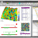
View 3D surface topography in 24-bit colors, manipulate it in real time, apply different renderings and palettes, make movies of surface flyovers, etc.
Clean up measurement data using powerful filters to remove anomalies, correct scan lines, etc. and use morphological filtering or tip deconvolution to minimize stylus or spot shape impact.
Increase vertical range virtually
Increase vertical range by manually patching together overlapping measurements on the vertical axis.
The most popular 2D and 3D surface texture parameters
Calculate 3D height and bearing ratio parameters defined in the new ISO 25178 standard and EUR 15178 (Surfstand), ISO 4287 2D primary and roughness parameters, BSI, DIN, JIS, NF, UNE and UNI equivalents of ISO parameters, together with and ASME B46.1 3D parameters.
Basic analysis of surface texture and geometry
Calculation of distances, angles, areas, volumes and step heights.
3D surface roughness analysis based on ISO 16610 advanced filtering techniques.
Basic functional studies including bearing ratio curve, depth distribution histogram, surface subtraction and more.
Analyze sub-surfaces too
Use segmentation or thresholding to extract a sub-surface – for example a disk fixture ring, contact zone, MEMS layer or valley region - and analyze it independently, calculating parameters (e.g. flatness) for the sub-surface only.
Fast surface metrology report creation
The highly intuitive desktop publishing environment (in seven European languages, Japanese, Mandarin Chinese and Korean) includes a page viewer for fast navigation, an analysis workflow for full metrological traceability and pass/fail traffic lights.
Series of measurements can be analyzed automatically using templates and common sequences of analysis steps can be saved in a library for insertion in future reports.
Data export (Excel .csv, text, bitmap, PDF).
| Author | Digital Surf |
| License | Trialware |
| Price | FREE |
| Released | 2014-09-29 |
| Downloads | 343 |
| Filesize | 511.00 MB |
| Requirements | |
| Installation | Instal And Uninstall |
| Keywords | surface profilometer, scanning opography, surface analysis, topography, profilometer, surface |
| Users' rating (22 rating) |
Using MountainsMap Scanning Topography Free Download crack, warez, password, serial numbers, torrent, keygen, registration codes,
key generators is illegal and your business could subject you to lawsuits and leave your operating systems without patches.
We do not host any torrent files or links of MountainsMap Scanning Topography on rapidshare.com, depositfiles.com, megaupload.com etc.
All MountainsMap Scanning Topography download links are direct MountainsMap Scanning Topography full download from publisher site or their selected mirrors.
Avoid: oem software, old version, warez, serial, torrent, MountainsMap Scanning Topography keygen, crack.
Consider: MountainsMap Scanning Topography full version, full download, premium download, licensed copy.


