NTv2Poly 8.02
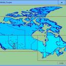
The spatial software NTv2Poly replaces the quadrangular activity scope contained in NTv2 files with a Polygonal Validity Scope, which is realized with an outline file in classic Shape Format. Invalid calculations outside the Polygonal Validity Scope thus can be excluded or acknowledged by a warning. Download the trial version from homepage Read the Worksheet at homepage Using NTv2 grid files it is possible to transform points from one coordinate reference system to another with very high accuracy. An NTv2 file contains one or more quadrangular coordinate grids which are defined in the NTv2 headers. Instead of a quadrangular area only an embedded polygonal area should and must be covered, for example, a state territory within the country borders. The program NTv2Poly realizes Polygonal Validity Scopes in NTv2 files. Using so prepared NTv2 files, coordinates outside the validity scope can be excluded from calculations or they can be acknowledged by a warning. This works with coordinate transformations using the geospatial software TRANSDATpro and GeoDLL by KilletSoft and with many GIS programs which support Polygonal Validity Scopes. The Polygonal Validity Scope is realized with a shape file, which contains the outlines of the scope as polygons. The file format Shape is developed by ESRI as a format for geographical objects. For example, in the shape file the border outlines of a country may be stored, which represent the polygonal scope for the NTv2 file used in that country. Using the program NTv2Poly the polygons of the shape file and the quadrangular surface of the NTv2 file are superimposed one on the other and processed in an ingenious manner. The program has a user-selectable multi language interface and comes with extensive online help. The program can be run on most common networks and it is possible to use Terminal Services on WINDOWS Servers.
| Author | Killet GeoSoftware Ing.-GbR |
| License | Free To Try |
| Price | $185.00 |
| Released | 2025-02-18 |
| Downloads | 249 |
| Filesize | 10.71 MB |
| Requirements | Pentium, 30 MB HD |
| Installation | Install and Uninstall |
| Keywords | inserting, insert, polygonal, validity, scope, scopes, NTv2, binary, file, outlines, outline, shape, shapefile, polygon, ntv2poly, killetsoft |
| Users' rating (27 rating) |
Using NTv2Poly Free Download crack, warez, password, serial numbers, torrent, keygen, registration codes,
key generators is illegal and your business could subject you to lawsuits and leave your operating systems without patches.
We do not host any torrent files or links of NTv2Poly on rapidshare.com, depositfiles.com, megaupload.com etc.
All NTv2Poly download links are direct NTv2Poly full download from publisher site or their selected mirrors.
Avoid: oem software, old version, warez, serial, torrent, NTv2Poly keygen, crack.
Consider: NTv2Poly full version, full download, premium download, licensed copy.