- Software
- - Graphic Apps
- - CAD
- - ProfLT
ProfLT 16.0
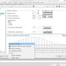
ProfLT is a program which offers functionalities for configuring, drawing and modifying longitudinal terrain profiles and cross sections.The author of TopoLT is 3D Space architecture office, which has a rich experience in office buildings and residential design, enjoying the recognition of many international companies.
Begining with version 9.0 the program was designed to work in AutoCAD or IntelliCAD environment in order to take advantage of the CAD application functionalities.
ProfLT application allows the insertion of points from a coordinates file, and based on the codes or on the 3D model the program generates longitudinal or cross profiles. The configuration options allow the user customization of the profile templates and saving of new templates, so all users can personalize the program depending on the their requirements.
Features:
generating profiles using 2D polylines with points, 3D polylines or the 3D model;
automatic generation of longitudinal and cross profiles using the point codes;
automatic drawing of points from coordinate files;
automatic joining of lateral points of the longitudinal profiles axis;
functions for modifying profiles, for joining and disconnecting them, for recalculation of orientation and reversing the profile;
predefined templates for various longitudinal and cross profile types (roads, high voltage electrical lines, sewage and water lines);
the possibility to save a new template for a custom transversal or cross profile;
the program options cover a wide variety of situations related to the profile generating and drawing modes, the profile rows can be arranged according to the job specification, the format for the sheets with the longitudinal and cross profiles can be chosen, etc.
preview the profiles before drawing;
quick drawing of longitudinal and cross profiles;
creating the page layout and arranging the profiles depending on the type of printer selected;
calculating height of platfom and drawing the labels of plaform heights;
exporting the profiles in specific Micropiste or SdrMap files;
the program is available in English and Romanian languages.
| Author | CADWARE Engineering |
| License | Trialware |
| Price | $300.00 |
| Released | 2023-10-16 |
| Downloads | 311 |
| Filesize | 13.20 MB |
| Requirements | |
| Installation | Instal And Uninstall |
| Keywords | AutoCAD tool, draw longitudinal profile, cross profiles, AutoCAD, Draw, Profile |
| Users' rating (18 rating) |
Using ProfLT Free Download crack, warez, password, serial numbers, torrent, keygen, registration codes,
key generators is illegal and your business could subject you to lawsuits and leave your operating systems without patches.
We do not host any torrent files or links of ProfLT on rapidshare.com, depositfiles.com, megaupload.com etc.
All ProfLT download links are direct ProfLT full download from publisher site or their selected mirrors.
Avoid: oem software, old version, warez, serial, torrent, ProfLT keygen, crack.
Consider: ProfLT full version, full download, premium download, licensed copy.


