Thuban for Windows 1.2.2
Thuban is an interactive geographic data viewer (GIS viewer) which features methods to visualize, explore, and analyze geographic information.
Thuban is an Interactive Geographic Data Viewer with the following features:
# Vector Data Support: Shapefile, PostGIS Layer and OGR
# Raster Data Support: GeoTIFF Layer and GDAL
# Comfortable Map Navigation
# Object Identification and Annotation
# Legend Editor and Classification
# Table Queries and Joins
# Projection Support
# Printing and Vector Export
# API for Add-Ons (Extensions)
# Multi-Language Support: English, French, German, Hungarian, Italian, Russian, Czech and Spanish
# User Manual (English)
Why is Thuban being developed?
[2001:] The FreeGIS Project provides an overview of Free Software GIS projects. Many valuable and highly sophisticated tools exist, but there is still a need for a user-friendly, interactive viewer for geographic information.
Thuban makes use of several Free GIS Software components and is itself the basis of advanced GIS applications, e.g GREAT-ER desktop
The project name Thuban originates from the alpha-star in the constellation Draco, the Dragon. It was the pole star when the Egyptians built the pyramids.
Thuban functions:
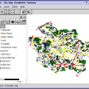
The Thuban Main Window falls into five major parts:
* Map
* Legend
* Statusbar
* Toolbar and
* Menubar
Layer Properties
Aside the layer title the properties dialog mainly focusses on the legend: The layers objects can be grouped by single values or ranges. Visibility and symbols can be edited per group.
Automatic Classification
Thuban supports explorative data analysis with automatic classifications of data. Supported are:
* unique values,
* uniform distribution and
* quantiles.
The number of groups is flexible, a ramp of symbols is generated for the resulting classification.
Projections
Thuban is distributed with a sample collection of projections and the set of coordinate systems as used by the EPSG (European Petroleum Survey Group).
For full flexibility projections can be assigned to the map and to each separate layer.
Table Management
The table view lists all records for a given layer. Data can be queried, the results are highlighted on the map. Additional data can be joined for detailed analysis and query results or entire tables can be exported.
Localisation
The Thuban User Interface is available for various languages:
* English
* French
* German
* Italian
* Spanish and
* Russian (cyrillic script)
Further translations are welcome.
| Author | Thuban Development Team |
| License | Open Source |
| Price | FREE |
| Released | 2009-08-18 |
| Downloads | 206 |
| Filesize | 11.22 MB |
| Requirements | |
| Installation | Instal And Uninstall |
| Keywords | geographic data viewer, gis viewer, analyze geographic information, information, geographic, viewer |
| Users' rating (23 rating) |
Using Thuban for Windows Free Download crack, warez, password, serial numbers, torrent, keygen, registration codes,
key generators is illegal and your business could subject you to lawsuits and leave your operating systems without patches.
We do not host any torrent files or links of Thuban for Windows on rapidshare.com, depositfiles.com, megaupload.com etc.
All Thuban for Windows download links are direct Thuban for Windows full download from publisher site or their selected mirrors.
Avoid: oem software, old version, warez, serial, torrent, Thuban for Windows keygen, crack.
Consider: Thuban for Windows full version, full download, premium download, licensed copy.


