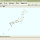
wxGIS Portable 0.4.1
wxGIS is a useful application that allows you to manage and to organize multiple types of geographic information. The program has an Explorer-like interface that is able to store the geographic coordinate systems in folders. It also includes a vector file export utility and a tool for correcting the orthographic data from raster TIFF files.
| Author | Dmitry Barishnikov |
| License | Open Source |
| Price | FREE |
| Released | 2012-11-15 |
| Downloads | 192 |
| Filesize | 9.70 MB |
| Requirements | |
| Installation | Instal And Uninstall |
| Keywords | GIS catalog, manage geography data, geographic coordinate system, manage, catalog, geography |
| Users' rating (8 rating) |
Using wxGIS Portable Free Download crack, warez, password, serial numbers, torrent, keygen, registration codes,
key generators is illegal and your business could subject you to lawsuits and leave your operating systems without patches.
We do not host any torrent files or links of wxGIS Portable on rapidshare.com, depositfiles.com, megaupload.com etc.
All wxGIS Portable download links are direct wxGIS Portable full download from publisher site or their selected mirrors.
Avoid: oem software, old version, warez, serial, torrent, wxGIS Portable keygen, crack.
Consider: wxGIS Portable full version, full download, premium download, licensed copy.


