Shadow Analyzer 2.2.1.1.1

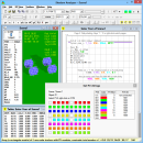
Shadow Analyzer helps you to optimize your sun-tracking or static PV-system in respect with shadows provided by the specific architecture environment of any particular site. It calculates the average yearly productivity of the project under your climate conditions. You can transfer data into other applications like MS Excel to compare different versions of your project and implement further numerical analysis or more specific research tasks. ...

Author Dr. Baum Research e.K.
License Demo
Price $1985.00
Released 2015-08-31
Downloads 139
Filesize 6.77 MB
Requirements Windows 7 and later
Installation Install and Uninstall
Keywords Parametric CAD, Shading Analysis, Solar Energy Engineering
Users' rating
(24 rating)
Shadow AnalyzerCADWin2000, Windows XP, Windows 7 x32, Windows 7 x64, Windows 8, Windows 10, WinServer, WinOther, Windows Vista, Windows Vista x64
Shadow Analyzer analyze information in - Download Notice

Using Shadow Analyzer Free Download crack, warez, password, serial numbers, torrent, keygen, registration codes, key generators is illegal and your business could subject you to lawsuits and leave your operating systems without patches. We do not host any torrent files or links of Shadow Analyzer on rapidshare.com, depositfiles.com, megaupload.com etc. All Shadow Analyzer download links are direct Shadow Analyzer full download from publisher site or their selected mirrors.
Avoid: analyze information in oem software, old version, warez, serial, torrent, Shadow Analyzer keygen, crack.
Consider: Shadow Analyzer full version, analyze information in full download, premium download, licensed copy.

Shadow Analyzer analyze information in - The Latest User Reviews

Most popular CAD downloads

TNTmips

20240404 download

TNTmips software is a complete Geographic Information System (GIS) that lets you work with virtually ... of natural terrains and mathematical surfaces from 3D information. Fast and efficient Surface Fitting, Contouring, and Triangulation ...

TNTmips for Mac OS X

20240111 download

TNTmips for Mac is a complete Geographic Information System (GIS) that lets you work with virtually ... of natural terrains and mathematical surfaces from 3D information. Fast and efficient Surface Fitting, Contouring, and Triangulation ...

MITO

2.0 download

... MITO toolkit makes it possible to fetch radiological information and images stored in a PACS according to the standard format DICOM, then provides the final user with basic functionalities such ...

Thuban for Linux

1.2.2 download

... viewer) which features methods to visualize, explore, and analyze geographic information. Thuban is an Interactive Geographic Data Viewer ... need for a user-friendly, interactive viewer for geographic information. Thuban makes use of several Free GIS ...

PowerNet

5.32 download

... radial type distribution. Use it to design and analyze electrical systems with multiple voltage levels, from high ... be supplied free of charge. PowerNet Circuit Analyzer functions and features: Draw and print single ...

5 award

UCL Depthmap

0.8.0 download

... agent is able to access the visual accessibility information for its current location from the visibility graph, and this informs its choice of next destination. The numbers of agents passing ...

Geogiga Front End

9.0 download

... single shot record. You can convert data formats, analyze amplitude decay, correct trigger delay, assign geometry, mute ... in batches with the preview of layout chart Analyze amplitude decay Vertical stacking Correct trigger delay Pick ...

Weather Station Data Logger

5.6.0.0 download

... the raw console data yields the following additional information: * 15-minute rate of change for temperature ... is updated once a minute with the following information: * Station and altitude-corrected pressure. * 1-minute ...

DSI Studio

.59 download

... Supported image format: · DICOM (multi-slices/mosaic) · Analyze/NIFTI · bruker 2dseq Tractography: · Stream-line tracking ... Supported file format for input ROI: text file, Analyze, NIFTI · Supported file format for output tracts: ...

Thuban for Mac OS X

1.0.1-3 download

... viewer) which features methods to visualize, explore, and analyze geographic information. Thuban is an Interactive Geographic Data Viewer ... need for a user-friendly, interactive viewer for geographic information. Thuban makes use of several Free GIS ...