Terra Excess 25.1217

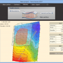
Terra Excess is land surveying and civil engineering software developed to be extremely intuitive. Even by those without previous experience, Terra Excess will allow you to handle the following tasks in just a few minutes - Generating and labeling contour lines in order to produce topographic plans and maps; Calculating accurate volumes of stockpiles and quarries or cut and fill volumes for Earthworks; Viewing and editing survey points. ...

Author Terra Excess Software
License Free To Try
Price $298.00
Released 2017-01-01
Downloads 98
Filesize 46.02 MB
Requirements CPU:1.5 GHz or faster, RAM: 1 GB or more, Disk space: 190 MB, Active internet connection
Installation Install and Uninstall
Keywords land surveying, civil engineering, topographic, contour lines, contour map, triangulated irregular network, earthworks, volumetric, volume calculation, cut and fill, volumes, estimating volumes, survey points, CAD, DXF, quarries, tin surface
Users' rating
(11 rating)
Terra ExcessCADWin2000, Windows XP, Windows 7 x32, Windows 7 x64, Windows 8, Windows 10, WinServer, WinOther, Windows Vista, Windows Vista x64
Terra Excess cad software - Download Notice

Using Terra Excess Free Download crack, warez, password, serial numbers, torrent, keygen, registration codes, key generators is illegal and your business could subject you to lawsuits and leave your operating systems without patches. We do not host any torrent files or links of Terra Excess on rapidshare.com, depositfiles.com, megaupload.com etc. All Terra Excess download links are direct Terra Excess full download from publisher site or their selected mirrors.
Avoid: cad software oem software, old version, warez, serial, torrent, Terra Excess keygen, crack.
Consider: Terra Excess full version, cad software full download, premium download, licensed copy.

Terra Excess cad software - The Latest User Reviews

Most popular CAD downloads

TurboCAD Deluxe

2016 download

TurboCAD Deluxe is powerful and complete 2D/3D CAD software. Setup wizards, snaps and alignment aids help you ...

CADopia 23 Standard

22.3.1.4100 download

CADopia 23 Standard (PERPETUAL license) is a full-featured CAD solution. The advanced features in this edition include ... major features supported in CADopia Standard are: Powerful CAD functionality: AutoCAD 2.5-2018 DWG Support Export Adobe Acrobat ...

Easy CAD Viewer

3.3 download

Easy CAD Viewer allows you to view and print various ... also enables you to manage 2D and 3D CAD drawings. Easy CAD Viewer works with AutoCAD DWG, DXF, DWF files ... as AutoCAD 2015. It is the fastest multiple-threading CAD drawings viewer available for Microsoft Windows all versions. ...

SCARM

1.9.8 download

SCARM is freeware program for simplified design of scaled railway model layouts and modelling of miniature model track routes. It has lightweight and intuitive user interface, 3D view and many other ...

5 award

CST CAD Navigator

1 download

CST CAD Navigator is an easy-to-use CAD software compatible with Windows, macOS, and Linux. It enables ... their dimensions and create section views. SUPPORTED FORMATS: CAD formats: DWG, DXF; Vector formats: PDF, SVG, CGM, ...

2D/3D cad: dwg, dxf, plt, cgm, svg, pdf

14 download

ABViewer is a multipurpose software to work with 2D and 3D CAD files. It supports AutoCAD DWG (2.5 - 2018), ... elements and measure them when necessary. Editing. The software has a wide range of tools to create ...

VeryUtils DWG to Image Converter Command Line

2.7 download

... drawings into image files easily without purchasing expensive software programs. VeryUtils DWG to Image Converter Command Line ... applications to do the batch conversion. With this software, you can easily convert your DWG and DXF ...

2D/3D cad: dwg, dxf, plt, cgm, svg, pdf

14 download

ABViewer is a multipurpose software to work with 2D and 3D CAD files. It supports AutoCAD DWG (2.5 - 2018), ... elements and measure them when necessary. Editing. The software has a wide range of tools to create ...

TNTmips

20240404 download

TNTmips software is a complete Geographic Information System (GIS) that ... integrates imagery along with geometric data including vector, CAD, shape, pinmap, and TIN formats. Maintain relational database attributes for vector, CAD, and shape layers ... The Job Processing ...

Easy CAD to Image Converter

3.2 download

Easy CAD to Image Converter supports conversion from DWG, DXF, ... GIF, TIFF, PNG, and TGA file types. Easy CAD to Image Converter is more than a file ... such as to facilitate the readers of your CAD drawings who have no AutoCAD-based software products installed ...