CityCAD 2.8.2

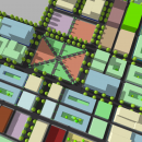
CityCAD is an easy-to-use design tool for conceptual urban masterplanning, sustainability and liveability analysis. You can sketch a network of streets, set building heights and land uses, and watch as floor areas, densities and other values are calculated automatically. ...

Author Holistic City Limited
License Trialware
Price $4000.00
Released 2016-03-09
Downloads 444
Filesize 102.00 MB
Requirements
Installation Instal And Uninstall
Keywords city design, urban development, residential designer, designer, city, urban
Users' rating
(12 rating)
CityCADCADWindows XP, Windows Vista, Windows Vista x64, Windows 7, Windows 7 x64, Windows 8, Windows 8 x64
CityCAD cad tool - Download Notice

Using CityCAD Free Download crack, warez, password, serial numbers, torrent, keygen, registration codes, key generators is illegal and your business could subject you to lawsuits and leave your operating systems without patches. We do not host any torrent files or links of CityCAD on rapidshare.com, depositfiles.com, megaupload.com etc. All CityCAD download links are direct CityCAD full download from publisher site or their selected mirrors.
Avoid: cad tool oem software, old version, warez, serial, torrent, CityCAD keygen, crack.
Consider: CityCAD full version, cad tool full download, premium download, licensed copy.

CityCAD cad tool - The Latest User Reviews

Most popular CAD downloads

Total CAD Converter

1.8 download

CAD Converter will help you to convert CAD files to tiff, pdf, bmp, jpeg, png, wmf, ... latest version supports Autodesk AutoCAD 2013 files. Total CAD Converter will also resize your files (except for ...

DataCAD

20.03.00.04 download

... architects and software engineers for architecture, DataCAD includes tools that make design and drafting easier, such as ... precision construction documents. More than just a drafting tool, DataCAD includes automated 3D modeling, and photorealistic rendering ...

TNTmips

20240404 download

... with associated database attributes. It provides all the tools you need to view, create, edit, georeference, interpret, ... type of geospatial data. TNTmips provides professional geospatial tools in a single package at an affordable price ...

VeryUtils DWG to PDF Converter Command Line

2.7 download

... is a DWG and DXF to PDF conversion tool, you can use it to convert DWG to PDF and DXF to PDF directly without need of AutoCAD. This software converts ...

Bmp2Cnc

2.90 download

... grayscale is quantified to adjust Z-axis depth, different tool overlaps, depths and tool radius are permitted. Final sizes of X-Y output ... size. Bmp2Cnc manages flat, toroid, spheric and conic tools. Bmp2Cnc also create an .STL file for 3d ...

Domus.Cad Pro

2.1 download

Domus.Cad Pro is an architectural BIM 3D CAD program. It is a tool for the design and modeling of architecture, interor, ...

5 award

HighDesign

2023.1.1.2184.0 download

HighDesign is the full-featured, fast CAD and architectural design solution to create precise drawings, ... HighDesign combines advanced drafting, project documentation and design tools with an elegant, easy and efficiency-oriented user interface ...

TNTmips for Mac OS X

20240111 download

... with associated database attributes. It provides all the tools you need to view, create, edit, georeference, interpret, ... type of geospatial data. TNTmips provides professional geospatial tools in a single package at an affordable price ...

CityCAD

2.8.2 download

... application for conceptual urban masterplanning. Unlike other CAD tools, CityCAD has been created specifically for the needs ... ready, you can export your CityCAD model in CAD and data formats for more detailed analysis later ...

R2V

3.66 download

R2V is a tool for converting raster images to vector by drawing ... A vector format can be imported into your CAD/CAM or drawing program. R2V supports the Bmp and ... vector (Scale, Rotate, Mirror, Move) and create simple cad drawing with Line, Rectangle, Arc/Ellipse, Polyline and Spline. ...