Image Constructor 2.5

Image Constructor helps you to create original illustrations, schemas and diagrams, simple geographical maps and location plans in form of texts and small images over some background with picture or gradient fill and save them to graphical files. Key features: support of most popular image formats; use prepared or your own image collections; options for object(s) and image edition; illustration scaling; export to HTML5, BMP, JPEG, PNG or GIF. ...

Author Image Tools Group
License Free To Try
Price $25.00
Released 2017-12-20
Downloads 571
Filesize 7.19 MB
Requirements No special requirements
Installation Install and Uninstall
Keywords imageconstructor, image, constructor, presentation, picture, geographical map, plan, graphics, webgraphics, flowchart, diagram, schema, image collection, GIF, publishing, homepage, imageediting, web, business, software, downloads
Users' rating
(14 rating)
Image ConstructorEditorsWindows XP, Windows Vista, Windows 7 x32, Windows 7 x64, WinServer, Windows 10, Windows 8
Image Constructor create map - Download Notice

Using Image Constructor Free Download crack, warez, password, serial numbers, torrent, keygen, registration codes, key generators is illegal and your business could subject you to lawsuits and leave your operating systems without patches. We do not host any torrent files or links of Image Constructor on rapidshare.com, depositfiles.com, megaupload.com etc. All Image Constructor download links are direct Image Constructor full download from publisher site or their selected mirrors.
Avoid: create map oem software, old version, warez, serial, torrent, Image Constructor keygen, crack.
Consider: Image Constructor full version, create map full download, premium download, licensed copy.

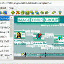
Image Constructor create map - The Latest User Reviews

Most popular Editors downloads

3DFieldPro

4.6.7.0 download

3DFieldPro, developed by Vladimir Galouchko, is a powerful and versatile software designed for creating three-dimensional surface maps and contour plots from a variety of data sources. This robust application is tailored ...

RasterStitch x64

4.0 download

... multiple raster images (stitching). Use this program to create a panorama of several photographs or scan and ... desktop A4 (21x29 cm) scanner or scan a map case of 50x50 cm by individual fragments and ...

Image Constructor

2.5 download

Image Constructor helps you to create original illustrations, structural schemas and diagrams, simple geographical ... GIF, ICO, PCX, PSD and Windows Metafiles; - creates background as color or gradient fill; - edits ...

easyHDR

3.14.1 download

... The HDR image (also called a HDR radiance map) has to be tone mapped, so it can ... you'll also find batch processing very useful. Just create a task list, choose settings and wait for ...

RasterStitch x64

4.0 download

... multiple raster images (stitching). Use this program to create a panorama of several photographs or scan and ... desktop A4 (21x29 cm) scanner or scan a map case of 50x50 cm by individual fragments and ...

HoudahGeo

6.4.3 download

... geotags to JPEG and RAW image files. This creates a permanent record of where a photo was ... add GPS track logs. * Use the built-in map to assign or adjust photo locations. Use reverse ...

Panorama Express Professional

3.0 download

... Express makes it very easy for you to create sophisticated professional virtual tours featuring: * easy-to-use ... Wizard for dramatically simplifying virtual tour creation -- create great virtual tours at the click of a ...

Dynamic Photo HDR

6.1 download

... A High Dynamic Range photography can be created by taking few photos with different exposure, then ... objects * Various tone mapping procedures that can create a whole range of images - from smooth ...

Dynamic Photo HDR for Mac

5 download

... A High Dynamic Range photography can be created by taking few photos with different exposure, then ... objects * Various tone mapping procedures that can create a whole range of images - from smooth ...

3DField

4.6.7.0 download

... comprehensive and efficient tool for anyone needing to create detailed 3D surface maps and contour plots. Its combination of user-friendly design, advanced features, and high performance makes it a valuable ...