ediTrail 1.0

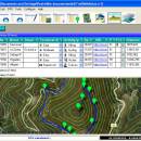
... over the map with vectorial CAD tools to create, move, split, join, invert trails and trackpoints, (trail vertices). ediTrail works in desktop mode and into CAD systems, (Autocad/Bricscad/Zwcad). ...

Author Aplicaciones Topográficas S.L.
License Freeware
Price FREE
Released 2014-11-07
Downloads 211
Filesize 27.05 MB
Requirements Desktop application, MIcrosoft operating systems, 32&64 bits
Installation Install and Uninstall
Keywords Trail, Route, GPS, gpx, geographical, latitude, longitude, utm, elevation, photo, Track, Way Point, Track Point, hiking, biking, cycling, map, land, terrain, surveying, DTM, D.T.M., digital terrain model, AutoCAD, BricsCAD, CAD, draw, points cloud, contouring, triangulation
Users' rating
(23 rating)
ediTrailOtherWin2000, Windows XP, Windows 7 x32, Windows 7 x64, Windows 8, WinServer, Windows Vista, Windows Vista x64
ediTrail create maps - Download Notice

Using ediTrail Free Download crack, warez, password, serial numbers, torrent, keygen, registration codes, key generators is illegal and your business could subject you to lawsuits and leave your operating systems without patches. We do not host any torrent files or links of ediTrail on rapidshare.com, depositfiles.com, megaupload.com etc. All ediTrail download links are direct ediTrail full download from publisher site or their selected mirrors.
Avoid: create maps oem software, old version, warez, serial, torrent, ediTrail keygen, crack.
Consider: ediTrail full version, create maps full download, premium download, licensed copy.

ediTrail create maps - The Latest User Reviews

Most popular Other downloads

Garmin Express

7.24.0.0 download

... seamless user experience, allowing you to effortlessly update maps, install software updates, and sync your data with ... your Garmin device is equipped with the latest maps and features, enhancing your navigation and tracking capabilities. ...

Epi Info

7.2.7.0 download

... data visualization, offering a suite of tools to create informative and visually appealing maps, charts, and graphs. These visualization tools are crucial ...

WinStars

3.0.304 (2025 download

... stars, thousands of deep-sky objects, and detailed planetary maps. This wealth of information is presented through a ... that combines scientific accuracy with stunning visuals to create an unparalleled astronomical experience. Whether you're looking to ...

Metes and Bounds

6.2.4 download

Metes and Bounds is a software that can create plot maps, perform calculations in square feets, acres, hectares, perimeter ... information like the interior and exterior angles. Create custom labels and backgrounds. Labels can be rotated ...

Windows Live Essentials 2012

16.4.3528 download

... Help keep your kids safe online. Writer Create stunning blog posts in minutes, with photos, videos, maps, and more. Then publish them to any of ... Writer Here's how to set up your blog, create blog posts, and add photos, videos, and maps ...

SnapGene Viewer

8.1.1 download

... visual representations of DNA constructs. Its interactive plasmid maps and sequence views offer a clear and comprehensive ... software supports the creation of detailed, publication-ready plasmid maps and sequence reports that can be easily shared ...

Google Earth

7.3.6.10155 download

... imagery, aerial photography, and geographic information systems to create a comprehensive and interactive 3D representation of the Earth. With its user-friendly interface and powerful features, Google Earth is a must-have ...

TrailRunner

3.7.745 download

... GPS recordings. · Internet Services - Load background maps and elevation data from openStreetMap and other services. ... famous iTunes rating stars. · Route Planning - Create new routes interactively or automatically, for a given ...

OziExplorer

3.95.6f download

... to work, on your computer screen, with digital maps that you have purchased or scanned yourself. By using these maps OziExplorer allows you to plan your trip by ... next map. Main Features: * Use maps or charts which you scan yourself. * Use ...

ExpertGPS

9.19 download

... Users have access to high-resolution aerial imagery, topographic maps, and street maps, ensuring they have the most accurate and up-to-date ... their fingertips. The software supports both USGS topo maps and seamless aerial photos, which can be invaluable ...