TNTmips 20240404

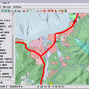
... handle desktop cartography, electronic atlas preparation and spatial database management. ...

Author MicroImages, Inc.
License Freeware
Price FREE
Released 2024-04-04
Downloads 756
Filesize 121.00 MB
Requirements
Installation Instal And Uninstall
Keywords GIS data analysis, analyze geodetic data, edit GIS dataset, GIS, dataset, editor, analysis
Users' rating
(52 rating)
TNTmipsCADWindows XP, Windows Vista, Windows Vista x64, Windows 7, Windows 7 x64, Windows 8, Windows 8 x64, Windows 10, Windows 10 x64, Windows 11
TNTmips data analysis software - Download Notice

Using TNTmips Free Download crack, warez, password, serial numbers, torrent, keygen, registration codes, key generators is illegal and your business could subject you to lawsuits and leave your operating systems without patches. We do not host any torrent files or links of TNTmips on rapidshare.com, depositfiles.com, megaupload.com etc. All TNTmips download links are direct TNTmips full download from publisher site or their selected mirrors.
Avoid: data analysis software oem software, old version, warez, serial, torrent, TNTmips keygen, crack.
Consider: TNTmips full version, data analysis software full download, premium download, licensed copy.

TNTmips data analysis software - The Latest User Reviews

Most popular CAD downloads

Geneious PRO for Vista

4.7.6 download

Geneious Pro is an integrated, cross-platform bioinformatics software suite for manipulating, finding, sharing, and exploring biological data such as DNA sequences or proteins, phylogenies, 3D ... publications, etc. It features sequence alignment and phylogenetic analysis, contig assembly, primer design and cloning, access to ...

PyMCA for Linux

5.5.5 download

PyMca has been developed by the Software Group of the European Synchrotron Radiation Facility (ESRF). ... implementing most of the needs of X-ray fluorescence data analysis. For the developer, the PyMca Toolkit ...

PyMCA for Mac OS X

5.5.5 download

PyMca has been developed by the Software Group of the European Synchrotron Radiation Facility (ESRF). ... implementing most of the needs of X-ray fluorescence data analysis. For the developer, the PyMca Toolkit ...

Gwyddion for Linux

2.66 download

... a modular program for SPM (scanning probe microscopy) data visualization and analysis. Primarily it is intended for analysis of height fields obtained by scanning probe microscopy ... used for any other height field and image analysis, for instance for analysis of profilometry data (learn ...

Gephi

0.10.1 download

... explore and understand graphs. Like Photoshop but for data, the user interacts with the representation, manipulate the ... reveal hidden properties. The goal is to help data analysts to make hypothesis, intuitively discover patterns, isolate ...

Gephi for Linux

0.10.1 download

... explore and understand graphs. Like Photoshop but for data, the user interacts with the representation, manipulate the ... reveal hidden properties. The goal is to help data analysts to make hypothesis, intuitively discover patterns, isolate ...

Gephi for Mac OS X

0.10.1 download

... explore and understand graphs. Like Photoshop but for data, the user interacts with the representation, manipulate the ... reveal hidden properties. The goal is to help data analysts to make hypothesis, intuitively discover patterns, isolate ...

SDMetrics

2.5 download

... to perform design measurement on such sources. Data export: ยท Design measures unleash their full potential when they are subjected to powerful statistical analysis procedures. SDMetrics exports measurement data and descriptive statistics ...

KMWin

1.52 download

... graphical presentation of results from Kaplan-Meier survival time analysis. The programme is an interface and intended to ... p-value accuracy Filter Window - Filtering survival time data by applying a filter string, catching filter strings ...

TNTmips

20240404 download

TNTmips software is a complete Geographic Information System (GIS) that ... you work with virtually any type of geospatial data including imagery, terrain surfaces, and map data with associated database attributes. It provides all the ...