Fityk 1.3.1

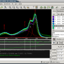
... nonlinear fitting of analytical functions (especially peak-shaped) to data (usually experimental data). There are also people using it to remove the baseline from data, or to display data only. ...

Author Marcin Wojdyr
License Open Source
Price FREE
Released 2018-10-18
Downloads 529
Filesize 3.10 MB
Requirements
Installation Instal And Uninstall
Keywords analytical functions, photoelectron spectroscopy, Raman spectroscopy, crystallography, analytical, chromatography
Users' rating
(8 rating)
FitykCADWindows XP, Windows Vista, Windows Vista x64, Windows 7, Windows 7 x64
Fityk data display - Download Notice

Using Fityk Free Download crack, warez, password, serial numbers, torrent, keygen, registration codes, key generators is illegal and your business could subject you to lawsuits and leave your operating systems without patches. We do not host any torrent files or links of Fityk on rapidshare.com, depositfiles.com, megaupload.com etc. All Fityk download links are direct Fityk full download from publisher site or their selected mirrors.
Avoid: data display oem software, old version, warez, serial, torrent, Fityk keygen, crack.
Consider: Fityk full version, data display full download, premium download, licensed copy.

Fityk data display - The Latest User Reviews

Most popular CAD downloads

CADopia 23 Standard

22.3.1.4100 download

... features of previous releases of CADopia. Drawing Comparision Data Extraction Wizard Associative hatching Improved batch printing Layer ... scaling Pattern hatch Curved text Drawing tab Heads-up display toolbar Layer state manager Polar tracking Ribbon interface ...

TNTatlas for Mac OS X

2024 B20240508 download

... you publish and distribute your maps and geospatial data — from a single geodata file to complex map layouts prepared using TNTmips. TNTatlas lets you display massive sized geodata and will directly display numerous ...

TNTmips

20240404 download

... you work with virtually any type of geospatial data including imagery, terrain surfaces, and map data with associated database attributes. It provides all the tools you need ... georeference, interpret, and publish any type of geospatial data. TNTmips provides professional geospatial tools in a single ...

CrystalMaker for Mac OS X

11.1.0 download

... workflow that majors on productivity: just drag-and-drop your data files into the program for instant display in spectacular photo-realistic colour. Manipulate structures in real ... the option of photo-realistic graphics or simpler, line-art display. CrystalMaker is the first program of its ...

TNTatlas

2024 B20240606 download

... you publish and distribute your maps and geospatial data — from a single geodata file to complex map layouts prepared using TNTmips. TNTatlas lets you display massive sized geodata and will directly display numerous ...

CrystalMaker

11.1.0 download

... workflow that majors on productivity: just drag-and-drop your data files into the program for instant display in spectacular photo-realistic colour. Manipulate structures in real ... the option of photo-realistic graphics or simpler, line-art display. CrystalMaker is the first program of its ...

CADopia 23 Professional

22.3.1.4100 download

... previous releases of CADopia. Drawing Comparision Stereolithography support Data Extraction Wizard Improved batch printing Layer support in ... scaling Pattern hatch Curved text Drawing tab Heads-up display toolbar Layer state manager Polar tracking Ribbon interface ...

TNTmips for Mac OS X

20240111 download

... you work with virtually any type of geospatial data including imagery, terrain surfaces, and map data with associated database attributes. It provides all the tools you need ... georeference, interpret, and publish any type of geospatial data. TNTmips provides professional geospatial tools in a single ...

GPS Utility

5.51 download

... GPS information. You can use it to transfer data to/from a GPS receiver and store the data in PC files in one of several text ... to show the position on a moving map display. An interface monitor is available for diagnostic purposes ...

5 award